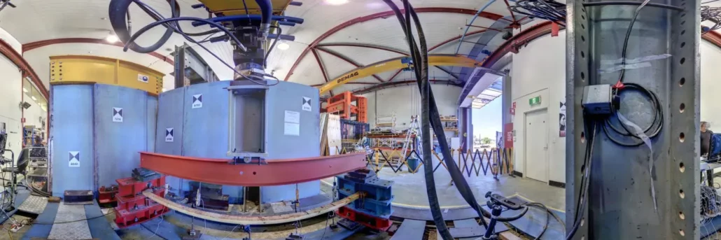
Masoud Mohammadi, a senior researcher of the Structural Assessment and Health Monitoring (SAHM) research group, led by Dr. Maria Rashidi at the Centre for Infrastructure Engineering (CIE), at Western Sydney University is collaborating with TfNSW on health monitoring of some state bridges across New South Wales. Mr Mohammadi and his team purchased the Z+F Imager 5016 3D Laser Scanner from Aptella because this instrument most reliably met the univeristy’s requirements and provided the highest quality results. The university completed stringent research before deciding to purchase the Z+F Imager 5016 3D Laser Scanner, as is the case with all special equipment purchases made by the university. The instrument needed to meet several requirements, including: cost of the instrument, local
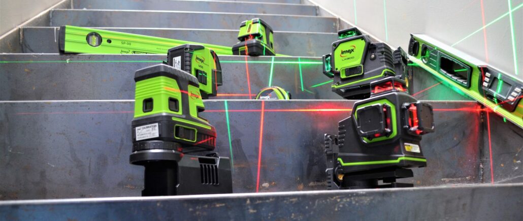
Aptella adds to its range of Topcon and aLine measurement tools with the acquisition of Imex, promising a laser to suit every budget and application. Intelligent positioning solutions provider Aptella announces the acquisition of Imex, an Australian-based company that specialises in laser levels and measurement tools for the building trades. “Laser levelling instruments have been a core part of our business since inception,” said Martin Nix, CEO of Aptella. “The addition of Imex to our solution portfolio means more options for our customers, with a laser level, or complementary measurement tool to suit every task and budget,” he added. “And, with outlets throughout Australia, as well as New Zealand, Indonesia, Malaysia and the Philippines, these essential construction
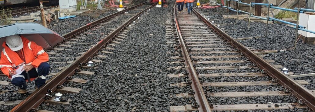
Australian surveying, digital & spatial and planning business Veris delivered around the clock deformation monitoring and reporting at Sydenham as part of the Sydney Metro City & Southwest Sydenham to Bankstown metro upgrade. Veris is a national, ASX-listed, company that provides comprehensive surveying, digital & spatial and planning services Australia-wide. Veris is currently providing surveying services for the Sydenham Metro Upgrade project, a major $301 million investment that involves significant upgrades to the existing rail track and Sydenham Station as part of the conversion of the T3 Bankstown line to Sydney Metro standards. Working closely with principal contractors John Holland and Laing O’Rourke, along with the client Sydney Metro, Veris recommended the use of wireless monitoring technology during

Aptella congratulates Richard Jackson on his appointment to Lead Product Management for Machine Control and GeoPositioning for Topcon Positioning Group. Passionate and visionary product engineer Richard Jackson will manage machine control and GeoPositioning product lines globally for Topcon Positioning Group. Aptella congratulates Richard Jackson on his latest promotion within Topcon Positioning Group. Based in Topcon’s Research and Development (R&D) facility in Brisbane, Australia, Mr Jackson has worked for the company for 21 years and has a longstanding working relationship with the Aptella team, Topcon’s exclusive Australian Distributor. “Richard is an innovative and skilled engineer who keeps the end user in mind when developing solutions,” said Martin Nix, CEO of Aptella. “We congratulate him on his appointment to lead
Topcon Positioning Group announces the launch of the Topcon Talks Construction podcast series The programming is designed to bring together a variety of guests offering unique perspectives on a wide range of topics impacting the industry. The first episode is available now for streaming with a new episode released every other week. The podcast format is ideal for on-the-go listening from the home or office to the job site, or wherever or whenever the listener wants to engage. The episodes are centered on industry discussions, whether it be a specific project or type of application to broader topics such as state-of-the-industry drivers, trends and opportunities. Among the guests in the first season are trade professionals, educators, organizational leaders,
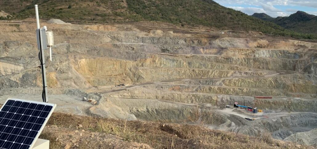
Mid-tier gold producer Evolution Mining rolls out Senceive wireless monitoring platform at its Mt Carlton site to deliver live reporting to supervisors and control teams. Mt Carlton is located 150km south of Townsville, Queensland. Operating a 500-metre by 400-metre pit and a 600-metre by 600-metre tailings dam, the company opted to introduce advanced deformation monitoring technology to deliver real-time status updates and alerts to its team. Evolution opted for Senceive’s GeoWAN solution, a long-range transmission system capable of covering areas up to 15-kilimetres. It incorporates several sensors placed along the tailings dam and/or pit walls to measure for minute movements in the surface. The sensors are wirelessly connected to a solar powered gateway, positioned near to the pit, where

Intelligent positioning solutions provider Aptella to distribute Soil Instruments’ geotechnical sensor range for specialised monitoring applications throughout Australia and New Zealand. Soil Instruments designs and manufactures a wide range of geotechnical monitoring instruments that are used to detect variations in pressure, strain, settlement, or other parameters in deformation monitoring scenarios. “Aptella has worked with Soil Instruments’ product range for 18 months for specific projects that have required specialised sensors,” said Andrew Jones, Monitoring Marketing Development Manager at Aptella. “Soil Instruments has an excellent reputation amongst engineers and geotechnical specialists for their high quality monitoring products,” he added. “Their range expands our monitoring solution portfolio, providing customers a more efficient technical and commercial offering,” he added. For almost 60
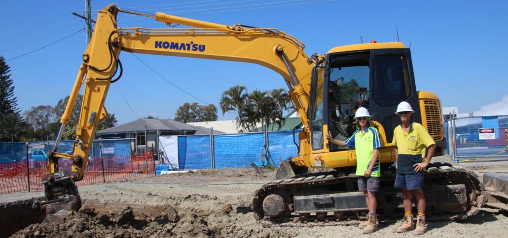
iDig is a simple 2D excavator system that gives the operator a live position of the bucket to guide them to grade quickly and accurately. It works with all makes, models and sizes of machine from little one tonne diggers up to mine excavators. Wayne Nicholson, owner and operator of Combined Excavations, explains they have the iDig system fitted to their two 1.5 tonne and 13-tonne excavators. “We utilise the 2D system to save us time on the ground as well as labour costs,” Mr Nicholson said. iDig helps operators get to grade in a range of applications, including slopes and levels, whilst providing real time information on the position of the cutting edge. It removes the need