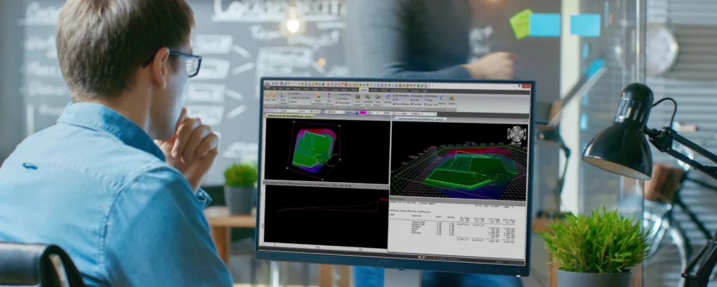
JG Civil delivers infrastructure works and specialises in larger sub-divisions operating in Rodney, North Shore and Auckland Central and West, in New Zealand. Neville Robertson, Engineer/Surveyor at JG Civil, is responsible for the set out of the works, preparation of as-built detail and progress claims, previously he would outsource the set out and would have to wait for the external supplier to complete this and provide information. On the advice of his hardware supplier, Mr Robertson engaged with Aptella to implement MAGNET Office software into his workflow. “We used to outsource this work but decided to do it internally. We now use MAGNET office to set out the roading strings and do the as-built files for the
Aptella berikan dukungan terhadap pengenalan automation technology pada sektor konstruksi dan pertambangan melalui pembukaan kantor baru dengan kapasitas yang lebih besar di Indonesia Aptella umumkan pembukaan kantor baru, lengkap dengan training and experience centre, di Kota Tangerang Selatan, di Provinsi Banten, Jabodetabek, Indonesia. Meningkatnya kebutuhan akan teknologi, presisi dan akurasi konstruksi pada pasar Indonesia, untuk meningkatkan poduktivitas serta K3 (Keselamatan Kesehatan Kerja). Hal ini menjadikan Aptella sebagai solusi baru penggunaan automation technology dengan penyediaan sarana pelatihan, konsultasi dan tenaga ahli. Aptella memiliki pengalaman industri lebih dari 30 tahun dengan fokus pada produk laser levels, grade control untuk kebutuhan peralatan pengerukan tanah, presisi, dan teknologi pemetaan. Didirikan di Australia pada tahun 2008, hingga kini telah mempekerjakan lebih dari 350
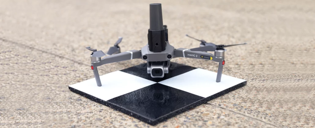
SmartSurveyor enables accurate aerial mapping, handheld photogrammetry and survey rover tasks and is compatible with DJI Mavic 2 and 3 series, or Phantom 4 Pro, drones. Aptella announces the launch of SmartSurveyor, a compact device that can be used for survey-grade aerial mapping projects in combination with the DJI Mavic 2 or 3 series, as well as the Phantom 4 drone. Unclip the SmartSurveyor from the aircraft and use it as a handheld photogrammetry tool with your smartphone camera, or a survey rover to measure ground control points. Unlike other drone mapping systems that rely on post-processed or real-time kinematic (PPK or RTK) technology, SmartSurveyor works with two or more ground control points (GCPs) and uses an iterative
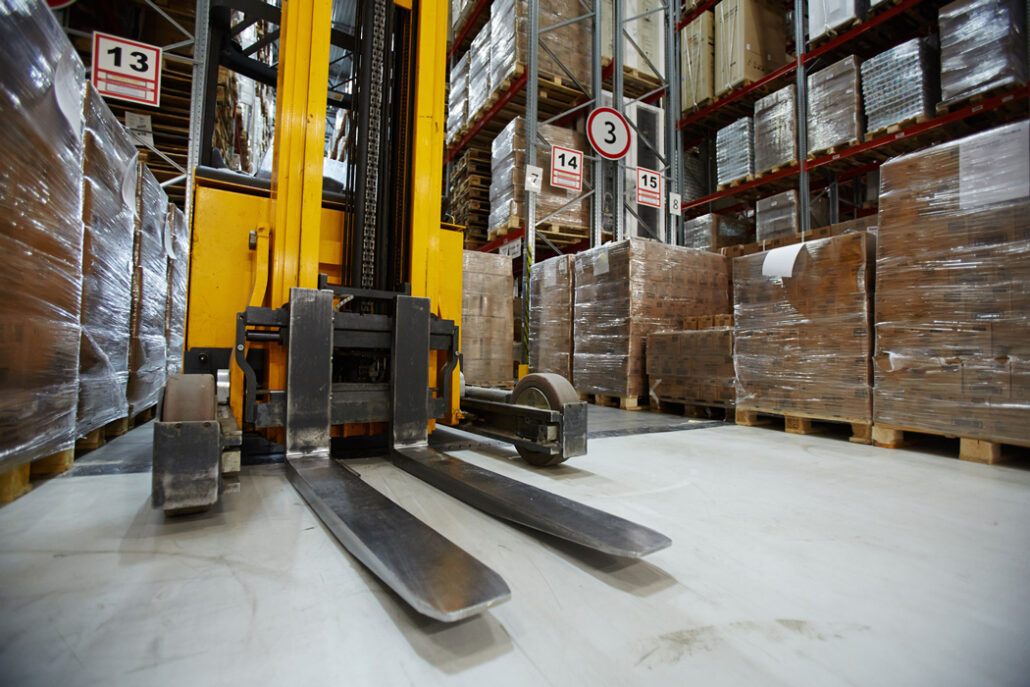
The company is looking for a Warehouse Specialist to join the team. The role will be reporting to the National Building Operations Manager. This is a full-time permanent role based at our Melbourne Office in Campbellfield. Key responsibilities will include: Incoming goods receival Picking of customer orders – internal transfers and external sales for dispatch Calibration of equipment for sales Maintaining and updating the ERP Inventory management Facilitate transportation requirements for outgoing stock Completion of stocktakes and cycle counts Ensure a safe working environment is upheld for self and other employees.. Key attributes. To be successful in this role you will have: Forklift licence Strong initiative Competent leadership and teamwork skills Understanding of practical processes and principles of
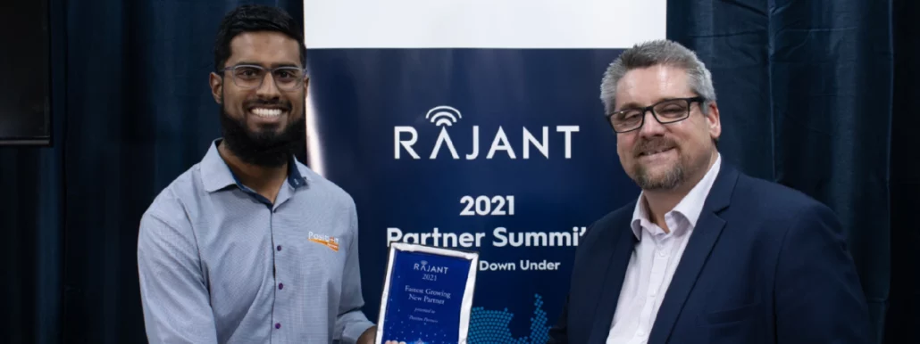
Intelligent positioning and autonomy solutions provider achieves top tier partnership status with Rajant to support mining customers with network technology requirements. Brisbane, 20th October 2022 – Aptella announces an upgrade to Premium Partner status with industrial mobile network communication provider, Rajant. The agreement will see Aptella continue to grow the reach of Rajant Kinetic Mesh® solutions across Australia, New Zealand and Southeast Asia for mining and other industrial sectors. “The Aptella team has been highly engaged with Rajant solutions since joining the partner program in 2019, winning Fastest Growing New Partner at our Australian summit in 2021,” said Troy McKay, Rajant’s APAC Sales Director. “We’re delighted to announce their achievement of top tier distributor status and look forward
Intelligent positioning solutions provider adds further regional support to customers in Queensland with the addition of sales and field service capabilities in Rockhampton. Rockhampton, 2 November 2022 – Aptella announces the opening of a new base in Rockhampton, Queensland, offering customers in the building construction, civil, mining and survey sectors access to local sales and service support. Following the company’s opening of a Townsville branch in May of this year, Queensland Region Manager Harry Katsanevas expressed Aptella’ commitment to supporting customers throughout the state. “Our customers are based and/or win work throughout the state of Queensland, so we are committed to being there to support them whenever and wherever they need us to be,” he said. “There’s a
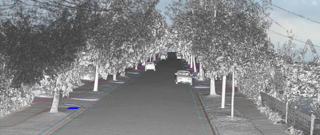
Asset Survey Solutions was looking for a solution to assist with a project that consisted of 3km of linear corridor made up of residential road and service pipeline, and the requirement to produce a full as-is condition survey from boundary to boundary that would be used as the reference state in a dilapidation survey. “Aptella was able to supply the NavVis VLX mobile scanning solution to complete the 1.5km residential section of the project,” said Patrick Hughes, Customer Success Manager – Scanning, Aptella. “The project represented an opportunity to use the new technology in the NavVis VLX, which was able to leverage a quicker capture time and still produce the required accuracies.” Scan data would not only provide

One of the questions we get asked the most when we’re helping a client design a sensor-based monitoring system is “How many do I need?” It’s a fair question and can be answered a few different ways depending on the scenario. In the case of a large structure or an infrastructure project, the quantity may be mandated by a monitoring scope which, depending on the technology in the mind of the engineer, could result in a reduced number of monitoring points. In other instances, an engineering specification such as a trackbed monitoring standard often drives the quantity and spacing of sensors. Beyond these scenarios, our clients’ present us with walls, embankments, highwalls, dams, benches, plinths, chimneys, wind turbines,