
Southeast Queensland surveying firm invests in NavVis VLX mobile scanning and successfully deploys Senceive deformation monitoring and Omnidots vibration monitoring systems across a range of infrastructure, construction, heritage and utilities projects. Bennett and Bennett has provided land surveying, town planning and spatial services throughout Southeast Queensland for more than 50 years. With more than 100 employees, the company is well resourced for small and large-scale projects and has adapted its business over time to embrace the latest technology and surveying methods. To complement the firm’s terrestrial mapping capabilities, Bennett and Bennett has recently taken delivery of a NavVis VLX wearable mobile mapping platform, sold and supported in Australia and New Zealand by Aptella. Powered by SLAM technology, the
Geotechnical practitioners need to monitor and forecast a collapse to minimise the risk of injury and damage to employees, equipment, and operations Near-real time decisions could be made regarding potential evacuations of mining or plant. The ability to not only understand long-term trends and patterns, but to detect sudden movement in near real-time is fundamental to monitoring critical assets Is it enough to be sent a text message or an email when an instrument indicates a significant ground movement? What if you could be sent an image to show you exactly what was going on when the movement occurred? Furthermore, what if you could have sensors autonomously increase their observation rate based on pre-determined criteria? Get your FREE whitepaper
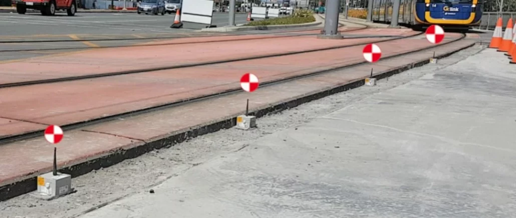
Senceive InfraGuard On-Demand Webinar Senceive’s new InfraGuard™ solution is a wireless monitoring solution that helps asset owners manage critical infrastructure. In this webinar, find out more about InfraGuard and how it: • is smart enough to wake up within seconds of a sudden event such as a landslip, sending alerts to remote stakeholders in time to act • gives you eyes on the situation before you can get boots on the ground – thanks to integrated cameras • has the built-in intelligence to prioritise alerts based on the severity of the event • can be installed in hours and perform for many years For instant access to this informative webinar, simply fill in your details below and we’ll
Solving drone workflow issues using Agisoft Metashape One of the more difficult aspects of using aerial survey drones is coming up with accurate drone positioning. You can’t always get every step of the process done efficiently, especially when drone and data functionality rely heavily on factors that are largely dependent on software. No two projects are exactly the same, and this variation of factors will always result in different data outcomes. We know that gathering accurate data is essential for surveyors using survey drones, and that processing workflows can add another layer of complexity. Aptella understands how best to overcome these setbacks and gain consistent data. So, we’re going to narrow down how we can play a part
Aptella announces the opening of a new branch in Townsville, offering customers in the building, civil, resources, and geospatial industry local access to a wide range of solutions and services. “We’re excited to welcome local customers to our new branch in Townsville today,” said Harry Katsanevas, Queensland Region Manager at Aptella. “Aptella is committed to supporting the industries we serve throughout metro and regional Queensland, through our branches in Brisbane, Townsville and support hubs in Mackay and Rockhampton.” As Topcon’s exclusive Australian distributor for positioning systems, Aptella complements Topcon’s range of retrofit machine control and survey solutions, with intelligent safety systems, on-board weighing, aerial and terrestrial mapping instruments, condition and vibration monitoring platforms and more. For the resources

Topcon Positioning Group announces a new option for Caterpillar Next Gen excavator users to leverage Topcon 3D machine control functionality together with Cat Assist features. As a result of new compatibility of the Topcon 3D Excavator System with Caterpillar factory-installed NGH sensors, customers will experience simplified installation of the Topcon aftermarket system into Caterpillar’s existing 2D excavator systems, in coordination with Topcon and Caterpillar dealers. Jamie Williamson, Topcon executive vice president, said, “With increased pressure for productivity and accuracy, and the industry’s need for skilled operators, the solution is timely. The customer will have the benefit of Topcon 3D Excavator System and Caterpillar Assist features working together. Once the user is acquainted with the combined system, it will
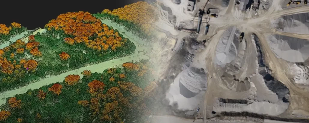
LiDAR imaging and Photogrammetry: two sides of the same drone Drone surveying is an ever-changing landscape, largely because drones are versatile and therefore can be outfitted with new equipment all the time. New innovations, methods, and techniques often change the way geospatial professionals approach worksites and tasks, which can really keep you on your toes. The two most well-known types of drone surveying utilise LiDAR imaging or photogrammetry. Both have their own benefits and drawbacks, and their usefulness depends on the specific application. Not sure which one to pick? No problem, we’ll walk you through your choices to help you decide what’s right for your project. The ins and outs of LiDAR imaging LiDAR stands for “light detection and
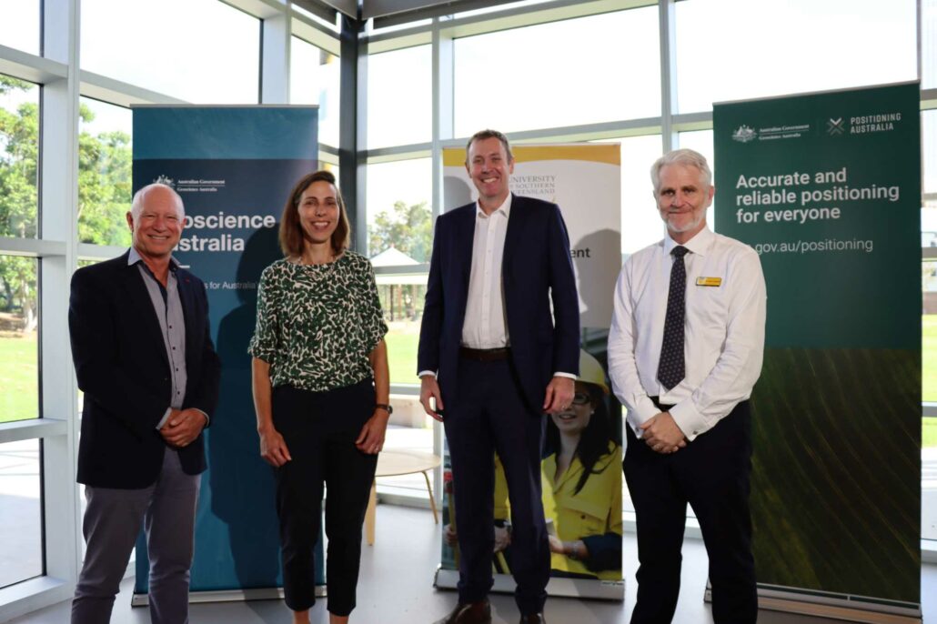
From left to right: Martin Nix, CEO Aptella; Martine Woolf, Branch Head, National Positioning Infrastructure, Geoscience Australia; Garth Hamilton MP, Member for Groom; Glenn Campbell, Head of School, USQ Queenslanders will benefit from advanced satellite positioning as the Australian Government partners with the Queensland Government, and the private sector, to improve GPS accuracy, taking the data available to Australians from metres down to centimetres. The Minister for Resources and Water, Keith Pitt said the Australian Government has made a significant investment towards national positioning infrastructure, as part of a $76 million annual investment into the Positioning Australia program led by Geoscience Australia. “For Queensland this means 156 continuously operating reference stations,” Minister Pitt said. “Nationally there will be