



The firm was an early adopter of terrestrial laser scanning, bringing that technology into its measured building survey workflow well ahead of many local peers, but it came with a familiar frustration: a great deal of information gathered in the field never made it back to the office in a usable form, since the quality of that handover depended heavily on how well the surveyor on site documented what they saw. Gaps meant return trips, and return trips meant cost, which is what led the firm toward simultaneous localisation and mapping, or SLAM, technology in the first place. After testing an early SLAM solution and finding it fell short, the firm moved to NavVis, drawn by a combination of accurate point cloud data and integrated 360 degree imagery, all accessible through the cloud. For a team with drafters based both locally and overseas, cloud access to a fully documented site was, according to the firm, the difference that made the technology worth adopting.
Lee Boon Haw Surveyors now operates two NavVis MLX handheld scanners alongside two NavVis VLX 2 wearable systems, applying each to a different kind of project. The NavVis VLX 2 was the firm’s starting point, well suited to detailed indoor capture for measured building surveys as well as topographical work where required. The NavVis MLX, more compact and easier to carry, has since extended that capability to smaller and harder to reach sites, including confined spaces and busy locations where hauling a full wearable rig isn’t practical. That portability has changed more than survey speed, with field teams now reaching smaller sites by motorbike rather than van, cutting transport time and sidestepping the parking constraints that come with operating in dense urban Singapore.
Beyond internal efficiency, the firm has begun sharing NavVis scan links directly with clients, giving them independent access to high fidelity imagery and point cloud data for their own review. It is a small shift with an outsized effect, since questions that would once have required a second site visit, confirming a detail in a corner, checking the location of a piece of fire equipment, can now often be answered from the scan itself.
“If there’s a query, like a detail in a corner or where a piece of equipment sits, the scan already has it,” Lee says. “That saves us the time and cost of going back down to site just to verify.”
That client facing transparency is arriving at a useful moment, as Singapore’s Building and Construction Authority progressively mandates digital submissions through its CORENET X platform, with BIM linked submissions already compulsory for large new developments and set to extend to all new building projects from October 2026. For existing buildings without a digital model, producing one from scratch is a costly, time consuming exercise, which is exactly where reality capture offers a practical middle step. A high fidelity point cloud, gathered once and stored centrally, gives stakeholders a base layer they can view, annotate and dimension immediately, and build up into a fuller BIM model incrementally rather than all at once, an approach with real weight in a market as densely built and constantly redeveloped as Singapore, where conservation and heritage requirements sit alongside new construction.
There is a workforce angle to this story too, since fieldwork in Singapore’s heat and humidity has long been one of the less appealing parts of a surveying career, and the firm sees modern reality capture tools as part of the answer, offering shorter field time and less physically demanding work while giving graduates a genuine reason to want to work with current technology rather than in spite of it.
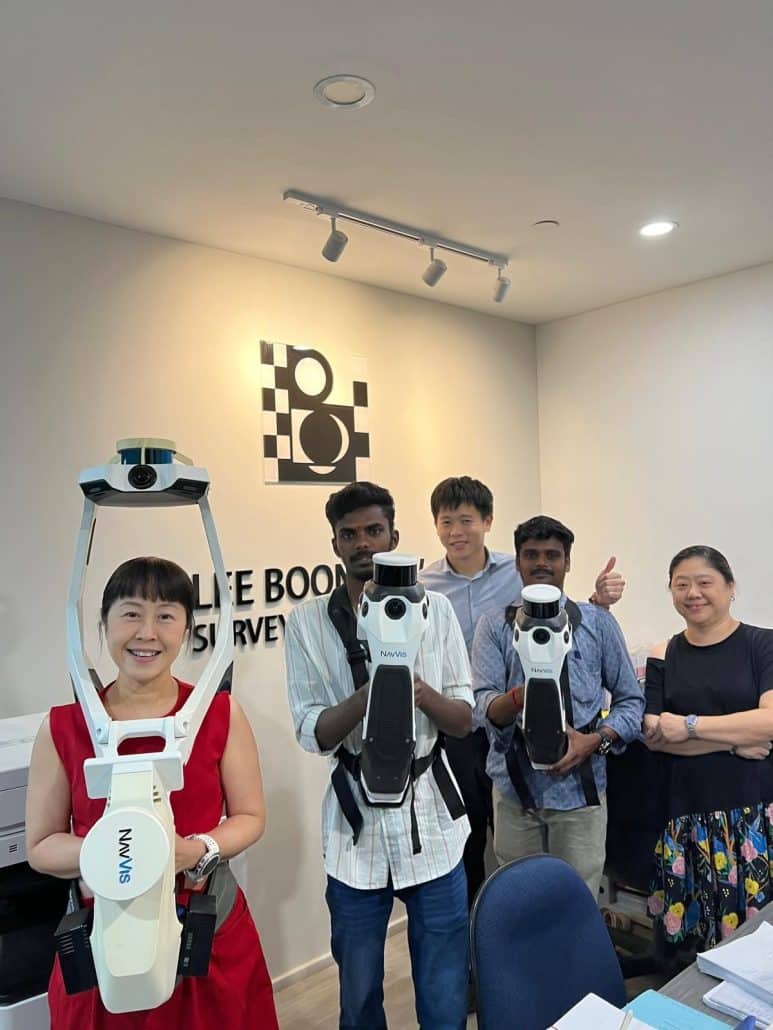
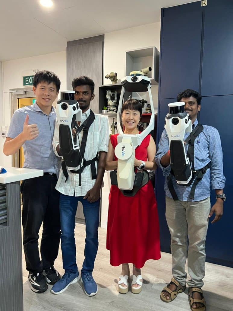
Aptella is proud to supply NavVis technology to Lee Boon Haw Surveyors in Singapore, and the firm describes the relationship as a genuinely supportive one, with strong technical assistance through the early stages of implementation. As Aptella’s authorised NavVis distributor across Australia, New Zealand and Southeast Asia, that support extends from initial deployment through to the ongoing use of NavVis IVION software back in the office, and it is this kind of end to end relationship, rather than a single hardware sale, that the two companies are keen to put on show. Since first adopting NavVis in March 2022, Lee Boon Haw Surveyors has grown into the largest NavVis user in Southeast Asia, a sign of how central the technology has become to the firm’s day to day survey work.
For a firm built on half a century of survey accuracy, the appeal of reality capture was never about replacing that discipline. It is about giving it a faster, more transparent way to reach the same result, and giving clients a reason to trust the data before they have even left their desk.
Traditional terrestrial laser scanning gave Lee Boon Haw Surveyors accurate data, but at a cost. Scanning was slow in the field, and a great deal of site detail was lost between the surveyor’s notes and the drafting team back in the office. Gaps in documentation meant repeat site visits, adding time and cost to every project, and Singapore’s dense, constantly redeveloping built environment left little room for that kind of inefficiency.
Working with Aptella, Southeast Asia’s authorised NavVis distributor, Lee Boon Haw Surveyors moved to SLAM based reality capture, deploying two NavVis VLX 2 wearable scanners alongside two NavVis MLX handheld scanners. The NavVis VLX 2 handles detailed indoor capture for measured building surveys as well as topographical work where required, while the compact NavVis MLX extends that capability to smaller, harder to reach sites, small enough for field teams to carry to site by motorbike rather than van.
Every scan is processed through NavVis IVION and made accessible via the cloud, giving the firm’s drafting team, including staff based overseas, direct access to fully documented, richly imaged site data without waiting on written notes from the field.
The Results
SLAM scanning has replaced slower terrestrial methods for measured building surveys and extended reality capture into outdoor topographical work.
Detailed 360 degree imagery lets drafters answer site specific questions, like confirming a corner detail or the location of fire equipment, without a second visit.
Clients receive direct scan links, giving them independent, self service access to verify site conditions and reduce query cycles.
The compact NavVis MLX has allowed some field teams to reach small sites by motorbike, cutting transport time and avoiding parking constraints in dense urban areas.
As Singapore's Building and Construction Authority extends its CORENET X digital submission mandate to all new building projects from October 2026, the firm's NavVis point clouds give existing developments a practical, incremental starting point toward a full BIM model.