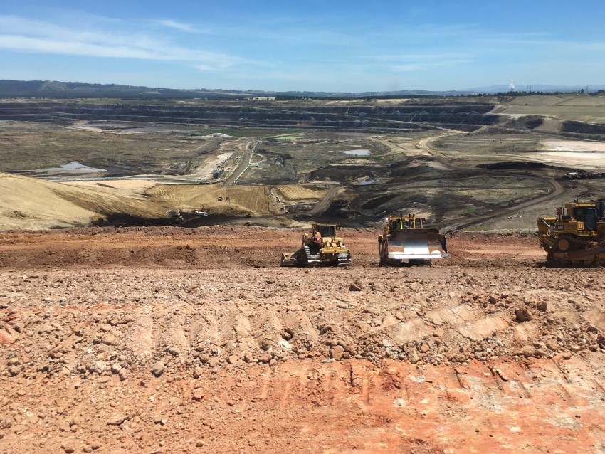
Collision awareness and proximity detection technology originally developed for the mining industry is set to become standard on major civil projects to protect workers and increase transparency for project managers. With limited space to manoeuvre and multiple heavy machines working in close proximity, roadside infrastructure projects can be a dangerous worksite. To reduce the risk of collisions between plant, people and utility or other fixed assets, geospatial positioning equipment distributor Aptella has introduced a range of proximity detection systems for civil construction applications by manufacturer Blue Electronics. Although collision awareness technology was initially developed to increase safety in mining applications, Blue Electronics’ solutions come with a enhanced features and failsafe measures to make them suitable for civil projects. Harry Katsanevas, Aptella
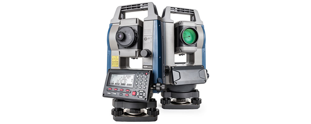
Sokkia introduces the latest addition to its iM line of manual total stations designed to provide powerful performance in an affordable package — the iM-50. “Whether operators need an instrument for jobs such as site layout or perhaps as-built survey, the iM-50 offers the perfect solution with high-end performance and exceptional functionality,” said Ray Kerwin, director of global surveying products. The iM-50 EDM features a prism range of up to 4,000 m and up to 500 m in reflectorless mode with a 1.5 mm/2 ppm accuracy. “The beam can precisely measure walls, corners, manholes on the road surface, even chain-link fences and tree branches. It offers a rapid distance measurement of 0.9 seconds regardless of the target,” he said. The instrument offers integrated
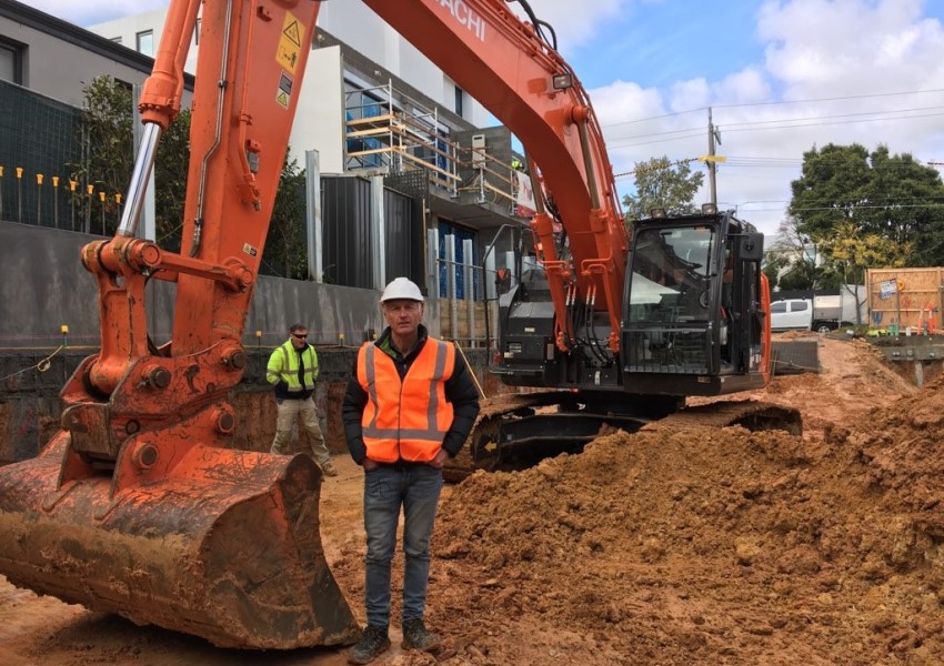
Andrew Blake, owner of Houlmann Blake Excavations, specialises in general construction works in Melbourne and is currently working on a typical basement excavation for an apartment block. Mr Blake has found that by implementing the iDig 2D machine control system from Aptella he has been able to avoid the regular challenges he encounters on site. “There’re no specific challenges we’re encountering on the site here, because we’re equipped with all the resources we need, and our team of operators also have all the latest technology available for them to carry out the works,” said Mr Blake. “We find the iDig system is working really well with the machines, the integration is seamless and we’re getting some great efficiencies out of our
PHL Surveyors has been using MAGNET software since the late 80s and first purchased a robotic total station, about seven years ago from Aptella. PHL Surveyors is involved in many facets of surveying, including, rural boundary definition, rural and urban sub-division as well as large scale irrigation design work, planning and engineering works. Alan Longhurst is one of three directors at PHL Surveyors and operates the Bungendore branch. “My role as a surveyor and planner is to take the projects in and distribute them to the staff. I do limited field work but I make sure that my staff is well equipped with the right technology and expertise,” said Mr Longhurst. “One of the projects we’re working on
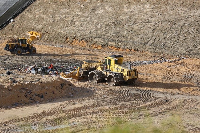
If you want to improve the efficiency and safety of your landfill site, implementing a machine guidance system, such as Aptella’ Carlson LandfillGrade, is one of the most productive ways to achieve this goal. “The Carlson LandfillGrade machine guidance system helps our customers improve the efficiency and safety of their landfill sites through the maximisation of vertical space, leachate management, avoidance zones for gas wells and hazardous material placement and access to better, more accurate data,” said Andrew Granger, National Manager – Mining, Solar and Landfill at Aptella. To assist landfill site operators to achieve their goals, the Carlson LandfillGrade machine guidance system will assist in optimising the amount of soil used for daily cover (along with the introduction of an alternate
Garry MacPhail, Geospatial Executive Manager for Aptella, reflects on technology evolution in the last two decades and its effect on the survey profession today and beyond. Having begun his career as a qualified engineering surveyor in the 1980s, Garry went on to start his own business selling and supporting survey equipment in Perth. His company Stadia Instruments – co-founded with business partner Bernard Cecchele – merged with four other state-based companies to form Aptella in 2008. In his tenure in the industry, Garry has witnessed significant shifts in surveying practice, amplified by the quantum leap in computing speed and processing power. Early 2000s – a step change in surveying “In the early 2000s, GPS was becoming increasingly mainstream
• The technology now streamlining the surveying profession has become financially viable for all survey practices – irrespective of size. • Australia’s nascent Space Agency will contribute to the success and speed with which local industries can leverage the potential from space related infrastructure. Aptella’ CEO, Martin Nix, has been an active contributor to Australia’s surveying profession and its adoption of technology since the mid-‘80s. Here he comments to the latest in satellite navigation systems and the potential impact of the Australian Space Agency. Surveyors first to use positioning frameworks I’ve been involved with GNSS (Global Navigation Satellite Systems – the generic term rather than the US system specific term- GPS) from the mid-80s. Surveyors were the first
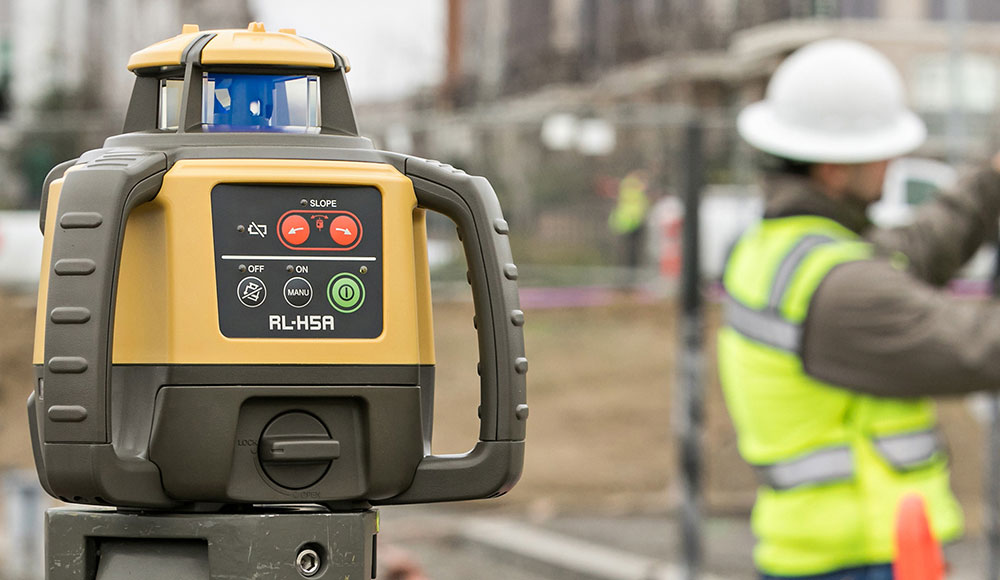
Aptella New Zealand now sells Topcon lasers nationwide. Intelligent positioning solutions provider Aptella New Zealand announces a distribution agreement with Topcon Positioning Group. The new partnership will see Aptella New Zealand distribute Topcon lasers throughout the country. Topcon Positioning Group designs, manufactures and distributes precision measurement and workflow solutions for the global construction, geospatial, mining and agriculture markets. Topcon lasers and levels are relied upon across the building trades to provide accurate, reliable measurements for general construction, concreting, earthmoving, building, plumbing and many other applications. “Aptella has been Topcon’s exclusive Australian distributor for many years, so we really have the expertise to maximise the results for our customers,” said Alex Felgate, Managing Director for Aptella New Zealand. “Topcon lasers are