
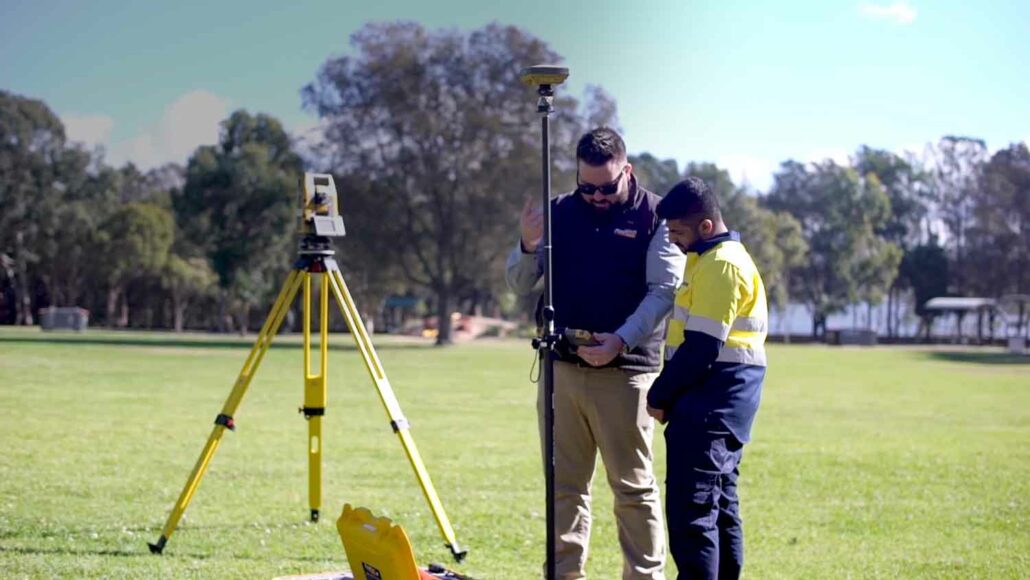
DM Civil is a mid-sized civil construction company in Western Australia, Australia that has a reputation for being early adopters of technology. Mark McGurdy, Survey Manager at DM Civil makes sure he’s abreast of any new developments hitting the market and this made him a natural fit to test MiRTK. “Karl O’Toole from Aptella approached me and asked if we’d be interested in testing MiRTK, to evaluate it and report on how it went. We gave it a go and we’ve been testing it now for a few months and like I say: Where you need it, it’s perfect! It works every time,” said Mr McGurdy. MiRTK integrates seamlessly with existing GNSS on site Mr McGurdy has a
Garry MacPhail, Business Manager – Geospatial, Aptella discusses the evolution of technology and its benefits for the surveying profession. After completing surveying college, Garry MacPhail, Business Manager – Geospatial, Aptella, discovered that his true passion was technology and how it could assist the surveying profession in automating a task or improving workflows. This passion led him into a career selling innovative equipment into the marketplace. “My biggest passion is automating a task and making a difference to the surveyor’s workflow. This has been the most important thing for me throughout my career,” said Mr MacPhail. “It’s that continuous improvement and refining Aptella’ products to give better productivity and help surveyors do their tasks better.” Evolution of technology Over
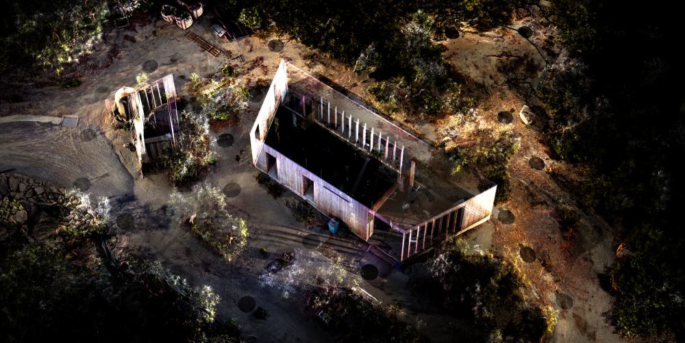
The team at JDA Co (JDA) were working on the Wilson Cottage & Villa project on Lizard Island on the Great Barrier Reef in Queensland, Australia when they introduced the Z+F IMAGER 5016 laser scanner from Aptella to this project because the challenging rock bed on-site needed to be explored with the design of the villa. Arjan Sandhu, Architectural Student, B. Arch Design, JDA explained that the Wilson Cottage & Villa project on the remote Lizard Island called for an ecologically sensitive design which respected the island’s remote and serene environment. This made it especially important that this environment was captured with the laser scanner. “As architects it is vital to go on site and explore the possible
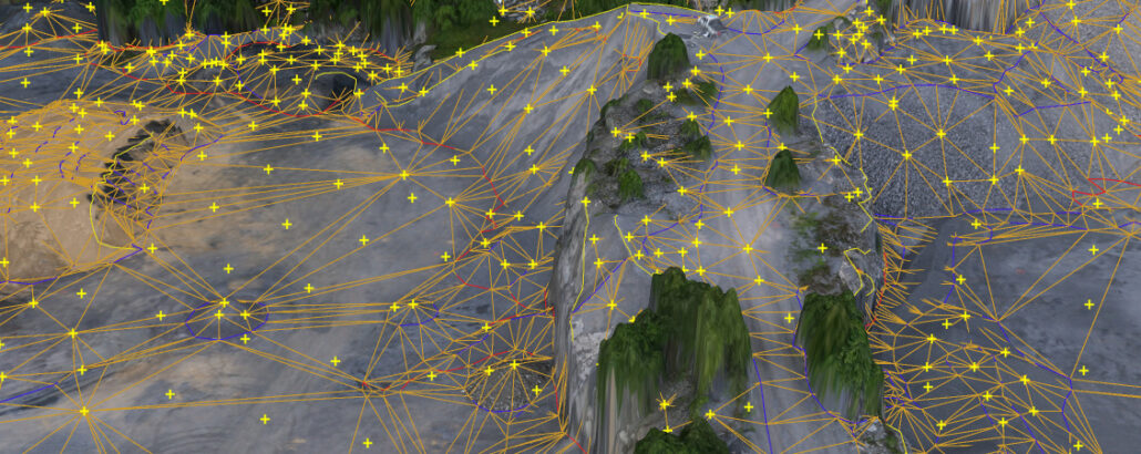
At Aptella, we make calculating your cut and fill volumes and ratios easier and more cost-effective with our line of innovative drones and drone technology. This new extensive range of drone technology is aimed at making site surveying easier and more cost-effective. By increasing the survey accuracy and utilising the high quality, durable and innovative drone and software programs, large site areas can be surveyed in half the time. By utilising remote flight technology, this cuts the number of boots on the ground required which is generally what increases surveying costs. What was once a 2-3 day job requiring sometimes up to 10 employees or surveyors has now turned into a half-day job needing only the aircraft pilot,
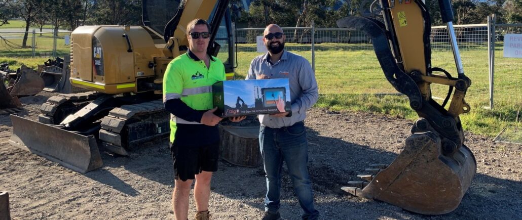
Billy Biletic, Director, Biletic’s Excavations had been researching the iDig 2D machine control system from Aptella for a few weeks when he came across a Facebook post by Aptella for an iDig 2D machine control system giveaway competition and won the competition with his photo entry. “When I came across it on Facebook, I started looking into videos and information on other people’s experiences with the system and what the technology can and can’t do,” said Mr Biletic. “I was impressed by the features of the iDig system.” Mr Biletic has the iDig 2D machine control system from Aptella installed on his 8t and 5t Caterpillar excavators and has found the iDig and machinery work seamlessly together. “I