Description
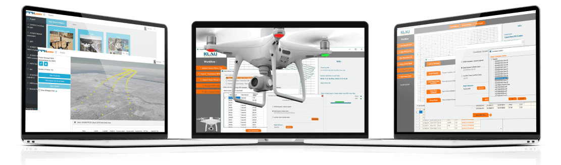
Purpose-built for the KlauPPK or PPP hardware solutions, KlauPPK software now also fully supports DJI RTK drones, including the Phantom4RTK and M210v2RTK.
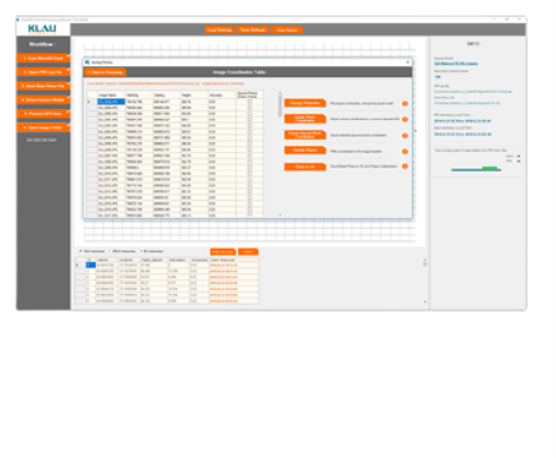
No Ground Control Points needed for survey grade accuracy
- Upgrade your drone to a survey accurate receiver to optimise your investment and reduce labour and integration costs
- Utilises CORS network base stations to reduce dependence on a base station
- 3D lever arm correction for enhanced accuracy – system automatically models the offset from GNSS antenna to camera centre – vital when drone tilts in different directions during flight
- Automatically converts default WGS84 coordinates to any published coordinate system and applies the geoid separation.
- Increased accuracy values with smart geotagging – horizontal and vertical values written to image data or text file for use in photogrammetry processing software
Now Integrated with DJI RTK drones
Process your aerial mapping data from DJI RTK drone with survey accuracy. Eliminate data loss and initialisation problems due to RTK (real time kinematic) radio links with PPK functionality.
- Works directly with DJI Phantom4RTK or M210 survey drones with no additional hardware required.
- Get longer range from the base station and more reliable data than using RTK processing
- Integrated base station data with no additional components
Reviews
There are no reviews yet.