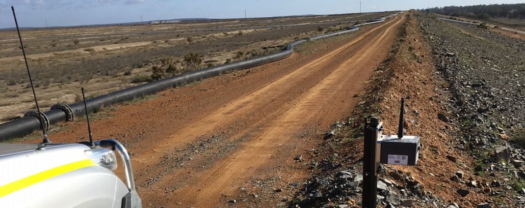
How are you monitoring your tailings storage facility? Access the on-demand webinar Join us for this webinar were we discuss the trends in dam failure, the capability of the Senceive hardware as well as an introduction to the WebMonitor platform. Aptella has been working with Senceive, the premier provider of wireless instrumentation, to assist mine sites monitor one of their highest risk assets: the tailings dam. In this webinar we will examine tailings dam failures, tailings dam construction; monitoring methodology and Senceive capability. Duration: 45 minutes Presenter: Andrew Jones, Deformation Monitoring Market Development Manager, Aptella and Heath Low, Deformation Monitoring Business Development Manager, Aptella Access Webinar
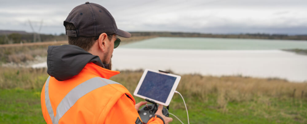
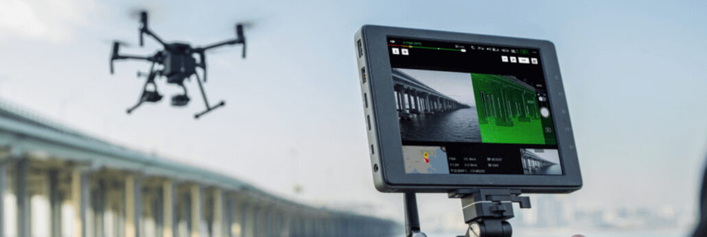
As an everyday practise, we have seen industrial services adopt the use of drones. Whether it is to accurately survey a construction site or to inspect remote infrastructure, The use of drones in construction has become increasingly popular as a way of safely and accurately getting field data to inform decisions on site. Drones have become increasingly popular in support of mining applications with exploration, surveying and mapping. Australia and Africa have led the way in adoption of unmanned aerial vehicles (UAVs) across their mining industries to maintain safety, increase oversight and enhance security. As an everyday practise, we have seen industrial services adopt the use of drones. Whether it is to accurately survey a construction site or
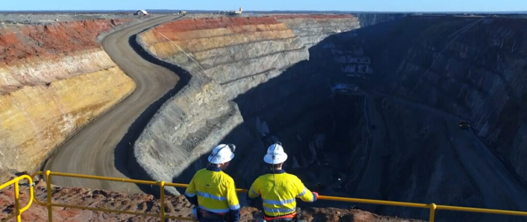
Over recent years, we have witnessed drone technology advancements push aside the traditional methods of mine monitoring and surveying. Drones have become increasingly popular in support of mining applications with exploration, surveying and mapping. Australia and Africa have led the way in adoption of unmanned aerial vehicles (UAVs) across their mining industries to maintain safety, increase oversight and enhance security. Drone Mining Survey UAVs (unmanned aerial vehicles) have been increasing in popularity in the mining industry for the last 10 years. As the technology has improved in leaps and bounds, so too has the number of drones deployed on mine sites for a variety of applications. Drones using cameras, LIDAR technology, or plugged into photogrammetry software, can create
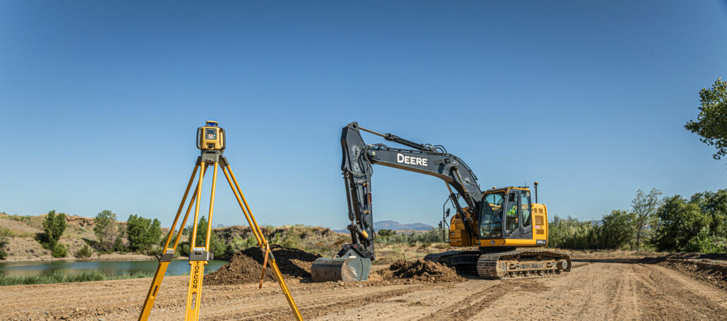
2D machine control (angle sensors, laser receivers, sonic trackers, etc) is where machine control started around 40 years ago and it is still the backbone of everything we do today in 3D machine control with GPS “A large percentage of applications are still powered by 2D machine control at heart, whether that be grading a slope on a motor grader with Topcon System 5 or digging a building pad on an excavator with iDig,” said Joel Seddon, Construction Business Manager, Aptella. “After all these years, the 2D world is still a gateway into machine control for so many and will continue to be so for years to come.” No matter how big or small your next project, Aptella
In the world of survey drones, major technological advancements have occurred over recent years. We have seen surges in payloads, aerial surveying capability, flight duration, flight distances and user operation technology Drones are essentially an aircraft that doesn’t have a human pilot onboard, instead, they are controlled by an autonomous onboard computer or an operator who is stationed on land. It is also common for most surveying UAV (unmanned aerial vehicle) drones to be equipped with VTOL (vertical take-off and landing) capabilities – as a matter of course in 2020. What is the Difference between VTOL and UAV in Aerial Surveying? We distinguish some drones used for aerial surveying as VTOL and some as standard UAV. It is
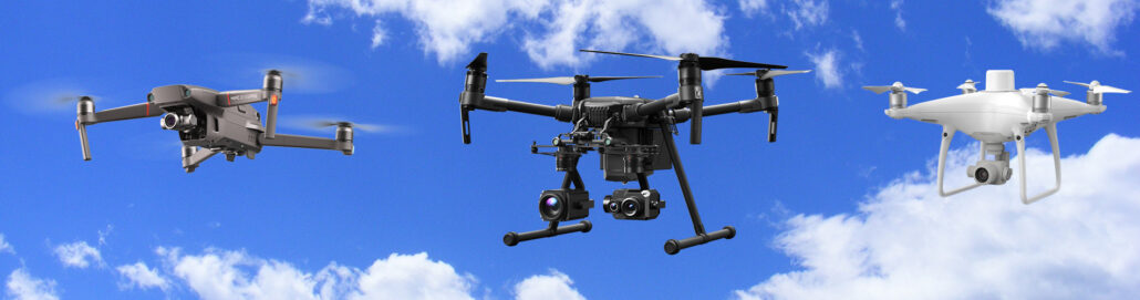
We classify our drones as unmanned aerial vehicles (UAV), which are aircraft without a human pilot onboard. This is the overall category of drone survey and geospatial equipment, which includes a range of different aircraft used for different survey purposes Within the UAV category of survey equipment is the latest flying and launching technology – referred to as V.T.O.L – which means an unmanned aircraft that has a Vertical Take Off and Landing. We talk more about VTOL and VTOL payload over here on this blog: Click here to read about VTOL Payload. This article dives deep into the different types of drones that are on the market today or about to be released – Aptella offer a
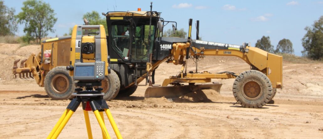
A guide to choosing the right technology, that’s backed by the right level of expertise Positioning technology is a broad term that encompasses a lot of different options for the civil contractor. With so much choice, including factory fit options from machine manufacturers, aftermarket options by different technology companies and various terms and descriptions that are not used consistently across the industry, it can become a mine field to uncover the right fit for your project. The top 3: Lasers, GPS and Total Stations In its simplest form, positioning technology is anything that assists machine operators, surveyors, engineers and project managers to match the physical landscape or structure to the digital (or, gasp! paper-based) project design. The most

Register Your Interest today For The Building Construction Site Set Out Made Easy Online Presentation and Demonstration! Aptella would like to invite you to book your place in one of our upcoming online presentation and demonstrations on how to easily do your own site set out with the Topcon LN-150. This is the latest site set-out tool from Topcon that will enable you to set out penetrations, wet-areas, holding down bolts, wet areas and generally take control of your site quickly and accurately without having to use stringlines or tape measures. During this presentation and demonstration we will look at the key features of the Topcon LN-150, go through the Topcon LN-150 workflow, show you how you can quickly