Search

NavVis VLX 3 – Wearable 3D Laser Scanner

NavVis 3d laser scanners

Scan More

Discover the new NavVis VLX 3 and NavVis IVION, the ultimate reality capture solution for your business.

Scan more with the new cornerstone of reality capture

Precision, accuracy, and reliability are central to what you do – they are the core principles of reality capture. And despite rapid changes, tighter budgets, and complex projects with stringent requirements, you’re still expected to do more – scan more, process more, model more, and offer more – with less.

With the new NavVis VLX 3 & NavVis IVION, we stand by those same principles, but our methods have evolved to make it possible for you to win more.


Get more from your workflow

New methods and tools need to integrate with and evolve existing toolkits and practices. Drawing on the established power of software and the cloud, NavVis helps professionals enhance their scanning, processing, and modeling toolkits to quickly document, verify, and collaborate on the world around us.

All-in-one, highly-detailed reality capture

Comprehensively capture 3D measurements with two 32-layer lidar sensors in combination with groundbreaking SLAM software to deliver industry-leading point cloud quality for a wearable device. Four cameras positioned on top of the device take high-resolution, sharp images in every direction for a complete 360º image – all without the operator appearing in the field of view.

Live scanning feedback

Monitor your scanning progress in real time with a built-in touchscreen interface to ensure complete coverage as you move.

Unboxing Video

NavVis

Got any questions about NavVis VLX 3?

NavVis customers have reported that up to 90% of their scanning projects can be completed with NavVis VLX. In addition, its value extends beyond large-scale projects and encompasses your entire project portfolio.

Dynamic scanning
Superb accuracy
All-in-one reality capture
What is SLAM?

SLAM technology is an algorithm that determines your location and trajectory as you move through a defined area. It processes information from the LiDAR sensors, Inertial Measurement Unit (IMU), and cameras to continuously calculate your position as you move.

SLAM is crucial in mobile mapping because, unlike terrestrial laser scanners that operate in a fixed (and known) location, the data is captured dynamically as you move. The sensors are in motion as you move through the space, which without SLAM would cause alignment errors.

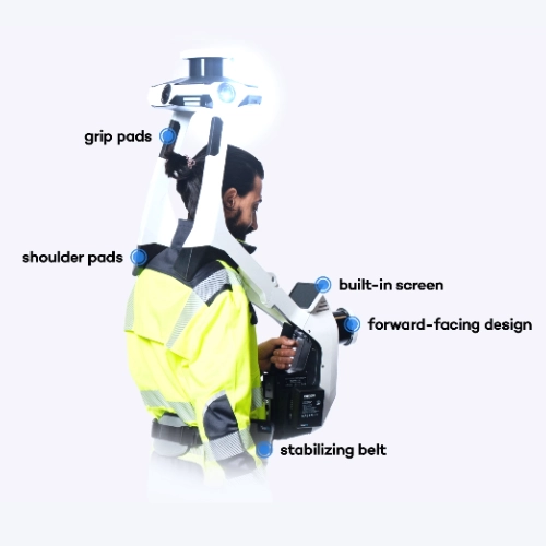
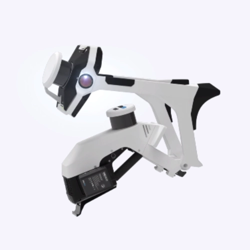
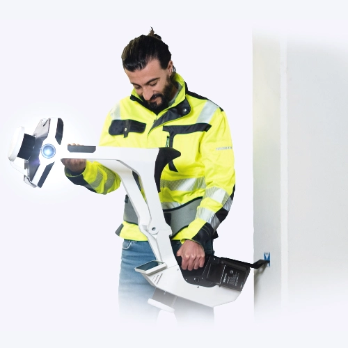
Precision meets ergonomics 

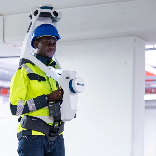
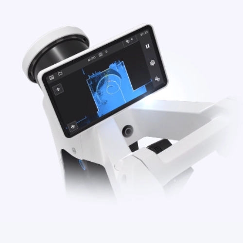
A first-of-its-kind wearable device which enables operators to comfortably scan at the speed of walking. The forward-facing design allows for targeted scanning, together with a built-in screen for optimal viewing.

  • Grip pads
  • Shoulder pads
  • Built-in screen
  • Forward-facing design
  • Stabilizing belt

Geo-registration

NavVis VLX 3 takes your laser scanning and survey workflows to the next level. It’s fully compatible with standard tools in the field, and can capture control points in a local site coordinate system measured by both Total Stations and GNSS rovers. It also supports national and global coordinates for precise geo-registration and alignment of datasets.

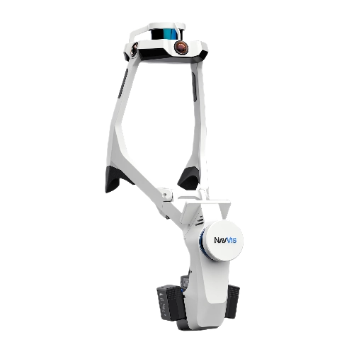
Innovative folding design

The unique hinged design folds up and fits into a protective case or backpack, so that a single operator can easily transport and set up.

Industry-leading data quality

Preserve original details

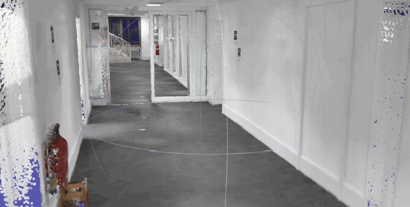
Point cloud surface reconstruction preserves details while removing noise for more efficient use in 2D drawings and 3D models.

Highly realistic texturing

Highly detailed point clouds include color and realistic texturing. In areas where images are not allowed, high definition intensity values enable better understanding of your environment.

Detect and remove dynamic objects

Objects that move through the scan are automatically detected and removed from point clouds during post-processing, resulting in less manual work.

Robust SLAM

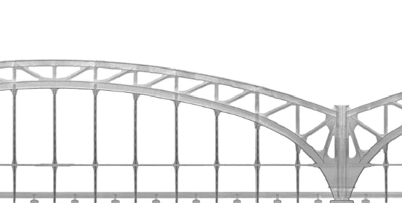
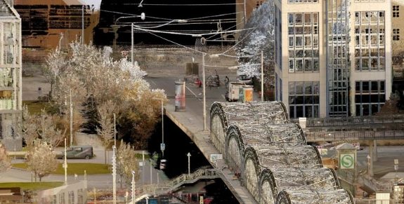
Robust SLAM algorithms can accurately capture the entire building including the facade and surroundings.

High detail at range

State-of-the-art lidar sensors generate twice the amount of data at range, optimizing the level of detail that can be extracted from the point cloud improving modeling accuracy and precision.

Reduced point cloud noise

NavVis VLX 3 generates sharper details and thinner point cloud slices for precise modeling and meshing results.

Want to learn more about this product? Contact us and we will be in touch soon!

A complete reality capture solution

Taken together, NavVis VLX and NavVis IVION Core offer a complete reality capture solution for the built environment that makes your digital assets accessible from everywhere.

NavVis VLX Customer Reviews

5/5
Liam Thierens/ Bennett + Bennett

“The VLX fills a gap in our scanning artillery and provides us the ability to quickly capture an environment from all angles without the shadows you find with static laser scanners”

5/5
Asset Survey Solutions

Using the NavVis VLX, Asset Survey Solutions was able to reduce time on the road from four days (traditional survey done with a total station and GPS) down to four hours of total scanning time, representing a reduction of 87.5% in time spent in a hazardous environment

Do you own this product? Tell us what you think!

Reviews

There are no reviews yet.

Be the first to review “NavVis VLX 3 – Wearable 3D Laser Scanner”

Your email address will not be published. Required fields are marked *

Request more information about this product

Request more information about this product