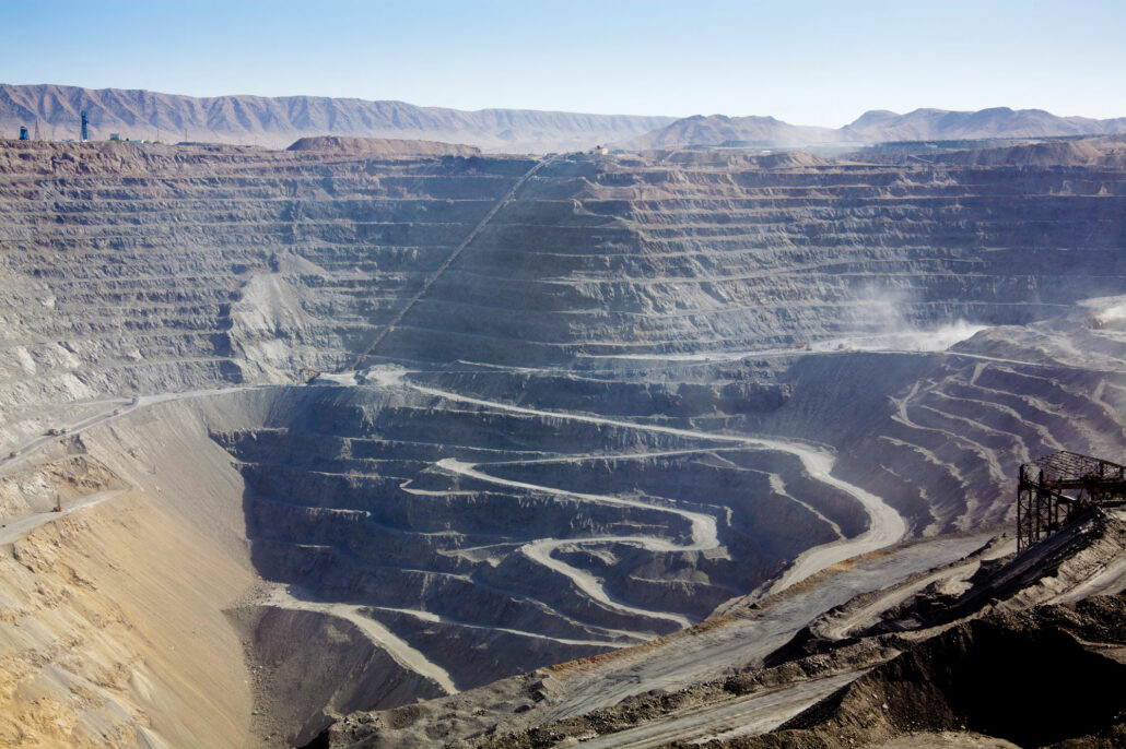
“The goal is to turn data into information, and information into insight.” Carly Fiorina, Former CEO of HP There is a misconception about data that the more you have, the more productive your mine operations will be. More information theoretically leads to more informed decisions, however if there is such an abundance of information that you don’t know how to pick out the meaningful parts, it can lead to frustration and inefficiency as you try to wade through data that is invisibly piling up around you. A report is only useful if it contains information that is wanted, delivered in a timely manner to the individuals and teams that can make informed decisions after reading it. So many
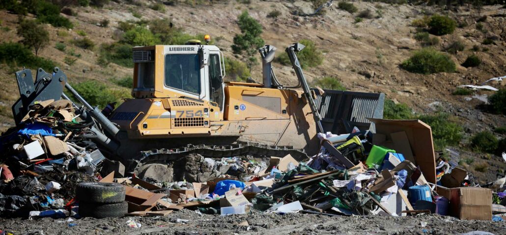
Using a machine guidance system, such as Aptella’ Carlson LandfillGrade, can help landfill site operators increase the efficiency, productivity and safety of their landfill site. “The Carlson LandfillGrade machine guidance system helps our customers improve the efficiency and safety of their landfill sites through the maximisation of vertical space, leachate management, avoidance zones for gas wells and hazardous material placement and access to better, more accurate data,” said Andrew Granger, Product Manager: Mining and Landfill Systems at Aptella. Maximise vertical space This solution from Aptella assists landfill site operators to maximise the void space of their landfill site through optimised compaction and increased density. Brad Wood, Operations Manager and Oscar Gallagher, Operations Coordinator at the Summerhill Waste Management
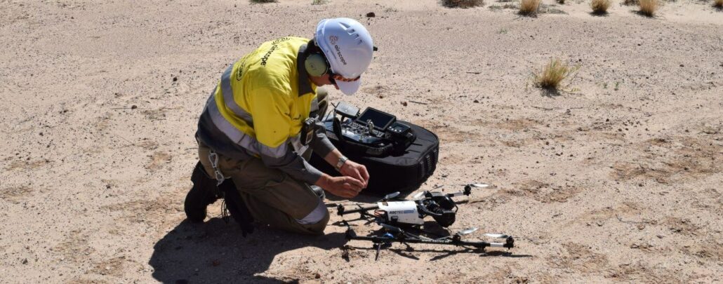
Airscope, a Perth-based inspections and asset visualisation company, was enlisted by Santos to provide large-scale virtual models of its facilities in the Cooper Basin, South Australia. Airscope needed to source the best drone technology to complete this project and found that Aptella’ Intel Falcon 8+ drone was the only drone up to the task. “When looking for the best drone for modelling these challenging landscapes, we compared 37 different aircraft that all claimed to be up to the specifications we needed,” said Francois Alberts, Chief Controller, Airscope. “When Intel’s distributor, Aptella, showed us the Intel Falcon 8+ drone, we found it to be the only aircraft which met our expectations, for its reliability, stability and true 3D modelling
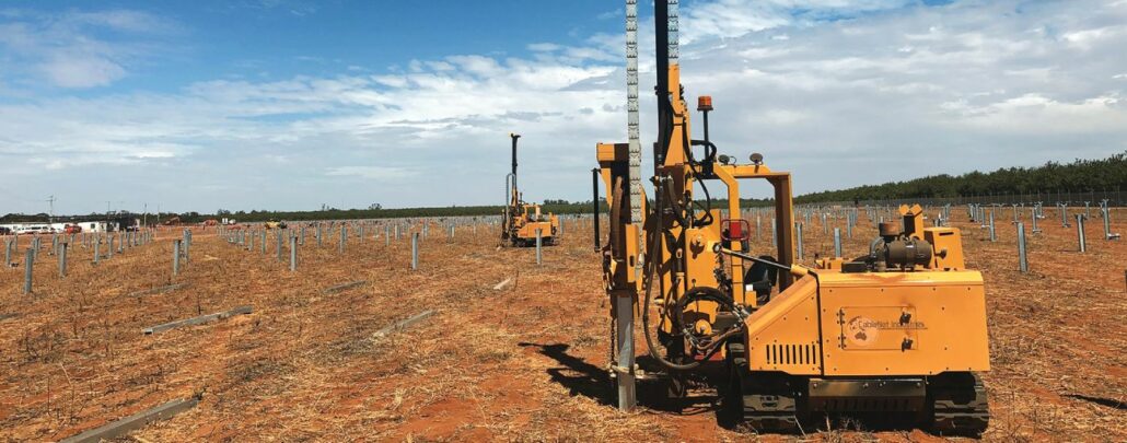
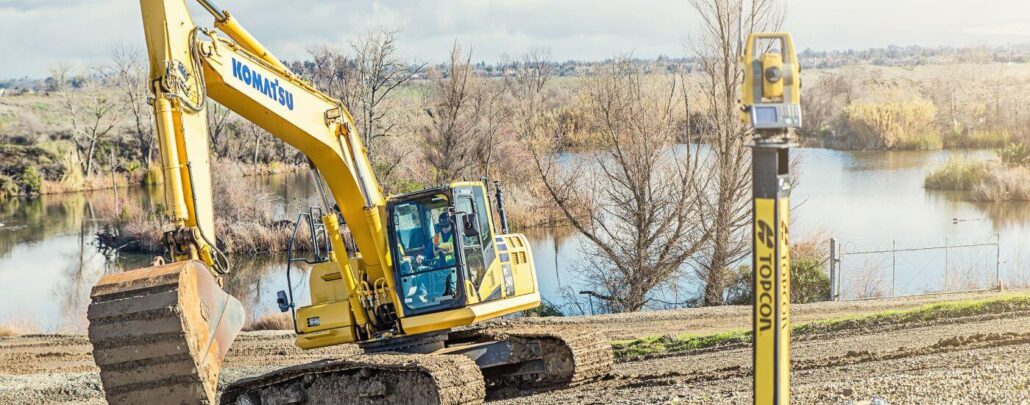
A combination of Carlson machine guidance, the Vermeer PD10 pile driver machine and technical support. A combination of Carlson machine guidance, the Vermeer PD10 pile driver machine and technical support promises increased productivity for the Australian solar industry. Intelligent positioning solutions provider Aptella has teamed up with heavy machinery manufacturer Vermeer Australia, to streamline pile driving applications in the solar industry. The amount of posts required for a solar farm varies greatly, from a few hundred to a few hundred thousand. Traditional methods are labour intensive with potential for human error, as they involve a surveyor manually staking out each pile location, along with continuous stringline installation to guide the machine operator. If any pile is a little off
Machine control technology is becoming a must-have option on many projects, with a range of systems that utilise laser, sonar, GNSS, total stations or a combination of them to guide the operator to grade accurately, efficiently and cost effectively. However watch out for getting stuck with a system that can’t be upgraded or swapped between machines. Every job is different and a single machine control system might not cut it for all of them. For example, grading house pads can be done very effectively with a 2D laser or sonar based system, whereas grading a road or larger project may need GNSS or a total station if there is dense tree coverage, overbridges or even tunnels. Contractors should
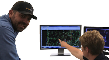
LandTeam, a multi-disciplinary, survey, civil engineering, town planning, project management and water servicing coordination company, was established from the merger of three companies and Greg Goodman, Managing Director of LandTeam found that the merger of three different companies meant there were three different lots of technology. Specifically, there was a range of five different survey software solutions, including MAGNET Office, being used across the company. Goodman and his team decided to streamline these five survey software solutions into one and MAGNET Office was the one that stood out. Why did LandTeam choose MAGNET Office? When Goodman decided to unify the software system, he chose MAGNET Office for a variety of reasons. “It’s widely used, it’s always progressing, it’s
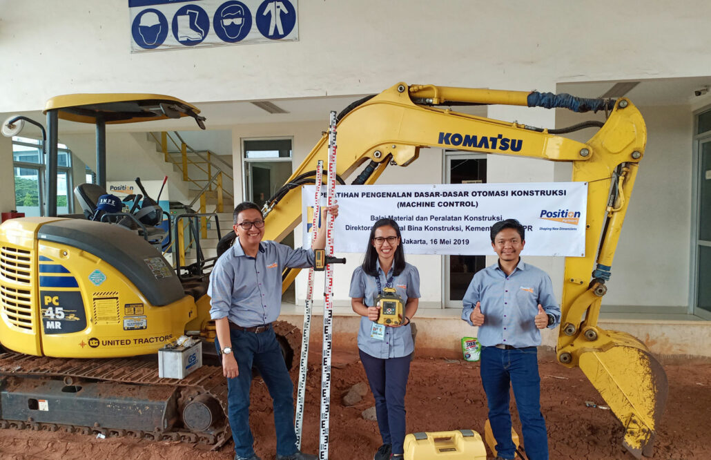
Aptella Indonesia is pleased to announce it has moved into its new premises. Aptella Indonesia has moved into its new office in Jakarta and warehouse in South Tangerang. The Aptella Indonesia team consists of four people and is very mobile and focusses on both sales and technical support. The new office and warehouse details are: Office: Beltway Office Park, Tower B, 5th Fl Jl. Letjen TB Simatupang No. 41 Jakarta, 12550 Phone: +62-21-2985 7387 Warehouse: Graha Bintaro Raya Blok GR-13 No. 11 Jl. Graha Bintaro Selatan 3 Tangerang Selatan 15226 “We are excited with the new working space,” said Bayu Murtiyoso, Country Manager, Aptella Indonesia. “It’s in a strategic location, in the area of South Jakarta business district with
Aptella, Australia’s largest retailer of positioning and geospatial solutions for surveying, mining and civil construction, have partnered with Klau Geomatics to bring the Klau PPK High Precision Drone module to the Australian market. Aptella provides the industry’s leading support for geospatial professionals with dedicated support centres across the country. Klau Geomatics is an innovative Australian technology company that produces one of the most accurate, compact and sophisticated aerial geo-positioning solutions for high precision mapping and inspection. The uptake of drone technology in construction, mining and inspection has put photogrammetry front and centre as the required skillset for the industry. There is a large gap here in knowledge and experience, that Aptella has filled by establishing themselves as the