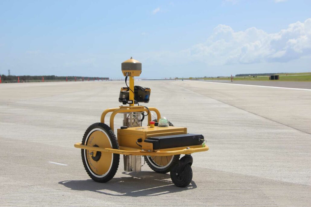
Aptella to exclusively distribute the Tiny Surveyor robotic pre-marker tool, across Australia and New Zealand. Geospatial solutions provider Aptella announces an exclusive distribution agreement with TinyMobileRobots, the Danish company that builds high-precision, reliable outdoor robots. The new partnership will see Aptella exclusively distribute the Tiny Surveyor robotic pre-marker tool throughout Australia and New Zealand. The Tiny Surveyor is a robotic pre-marker tool that saves time, increases safety and enables the user to mark out road lines automatically. It is reliable and repeatable with 2-3cm accuracy and versatile enough to accommodate different spray can sizes. With the ability to interface to any GNSS as well as Topcon and Sokkia total stations for precise height measurements, the Tiny Surveyor is
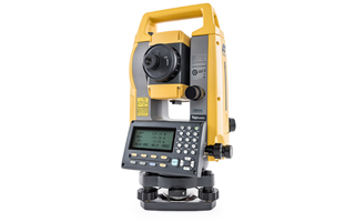
The Topcon FC-5000 survey tablet has been upgraded with new productivity enhancing features. The FC-5000 is already a market leading piece of equipment and with these new features coming in March, the world’s best survey tablet just got better! The Topcon FC-5000 survey tablet is now available with double the storage, a huge 128GB. This means that you can manage all your jobs in a single place and on a single survey tablet. The Topcon FC-5000 survey tablet has also been upgraded to allow a massive 500m Bluetooth range to our precision Topcon GT and Sokkia iX robotic total stations. “Not all tablets are the same, the surveying profession has unique requirements and sometimes it’s the small things that

Aptella is pleased to announce that Andrew Jones has joined the company as the second Business Development Manager in the Monitoring Solutions Team. In his new role, Mr Jones will be responsible for the New South Wales and Southern regions. Mr Jones has built a 20-year career as a geologist in the mining industry and comes with an extensive array of operational experience both domestically and abroad. With a background in mines rescue and emergency services, Mr Jones is passionate about providing solutions contributing to the safe operation of projects. Whilst in Mount Isa, Mr Jones gained experience in both underground and open cut mining processes whilst catering for challenging geotechnical conditions requiring various monitoring solutions. This included
What is machine control? Machine control systems allow contractors to maintain tight tolerances which led to great material savings and the cost reduction cost of earthmoving operations. All of this added to the contractor’s bottom line. Machine control technology is quickly becoming standard and contractors are realising that they need to implement this technology simply to stay competitive. Bidding a job now without factoring in the productivity gains from machine control is becoming increasingly difficult. We hope this information will serve to educate the reader and assist those who are contemplating investing in machine control in making an informed decision. For those who are already using this technology, we will explore ways to maximise the utilisation and productivity
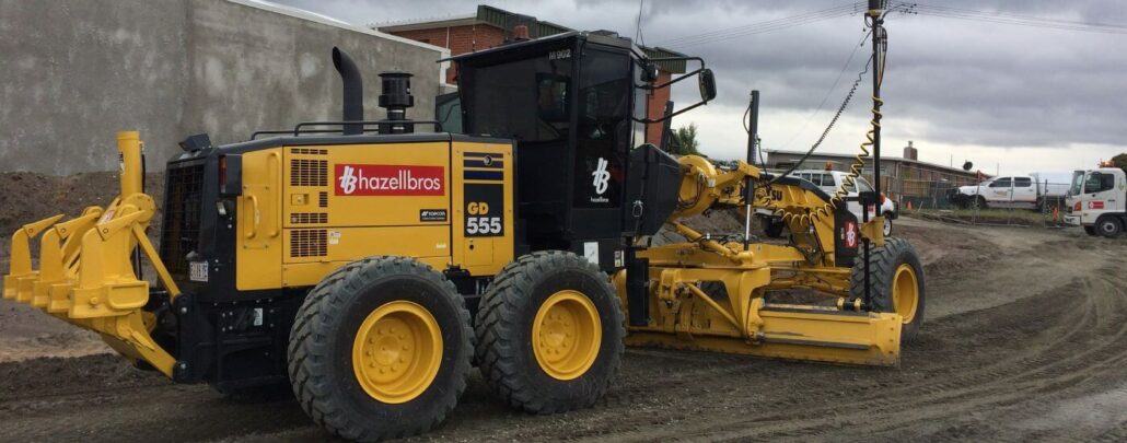
GPS/GNSS-based 3D grade control systems have made a major impact on how heavy construction is done, but they still have limitations when it comes to achieving very tight vertical accuracies. This is true regardless of which brand you use. While multi-constellation (GPS, GLONASS, Galileo and more recently Beidou) grade control systems are able to work in more places and under more adverse conditions, these systems are still subject to various orbital errors and environmental factors, which can degrade the vertical accuracy. Many contractors use GNSS-based 3D grade control exclusively for earthmoving tasks and even finishing. However, the manufacturers of these systems will confirm they cannot guarantee that the vertical accuracy will be good enough for finishing. The various
Topcon Positioning Group announces the new GM-100 total station designed to provide a powerful EDM along with advanced integrated communications technology in a manual package. “It delivers the latest technological advantages in a small, sleek design,” said Ray Kerwin, director of global surveying products. “Whether operators are performing tasks such as site layout or as-built survey, the instrument delivers high-end performance with a best-in-class accuracy of up to 6000 m and 1.5 mm + 2 ppm with a prism and up to 1000 m and 2 mm + 2 ppm in reflectorless mode.” The GM-100 features dual-axis compensation designed to ensure stable measurements even on rough terrain by automatically correcting both horizontal and vertical angles. This total station integrated

Many prospective 3D machine control system buyers quickly grasp the concept that a GPS/GNSS (Global Navigation Satellite System) antenna or LPS (Local Positioning System) prism mounted on the blade of a motor grader allows the position of the cutting edge of the blade to be known in real time. However, how the computer in the machine cab knows where grade is and how it gets that information deserves an explanation. What does a 3D machine control system do? A 3D machine control system essentially bypasses the traditional process of grade staking. Instead of giving site plans to the surveyor, who uses these plans to manually set the stakes and then having the machine operator visually read those stakes,
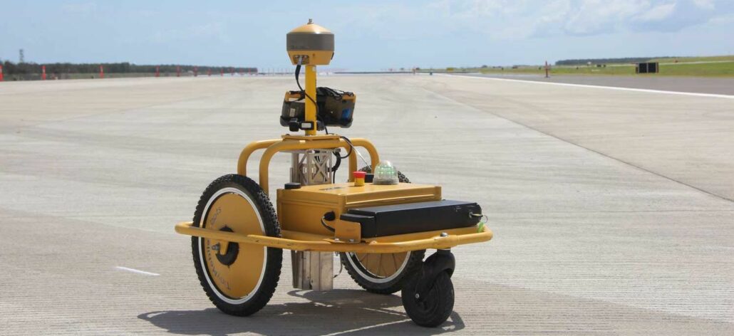
A new road marking robot negates the need for surveyors to manually set out road lines on foot, saving time, dramatically improving safety and often removing the need for traffic control on live roads altogether. Tiny Surveyor is a compact road marking robot that is designed to automatically mark out roads, sports fields, car parks and other line marked surfaces using a pre-programmed design. Distributed in Australia and New Zealand by Aptella, this unique piece of equipment promises to be a great time saver for surveyors in the construction industry. “Automation is developing apace across all industries with the aim of increasing safety, saving time and reducing or eliminating human error,” said Garry MacPhail, who manages the Geospatial