RTK in Agriculture
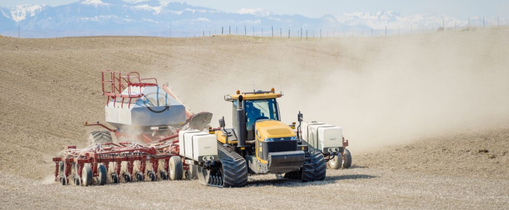
Real Time Kinematics (RTK) is used in field robotics to help a mobile robot position itself in the world, and use that information to navigate in real time around obstacles and to waypoints depending on their application. Robots Using GNSS Satellite Data To Navigate Outdoor Spaces Require An RTK Correction System To Filter Out Errors In The GNSS Data, Including Clock Errors, Orbit Errors, Satellite Biases, Atmospheric Errors, And Multipath. RTK for mobile robots Field robotics is a sector of research focussed on building mobile robots – robots suited for performing in the field, rather than in closed environments such as warehouses or manufacturing plants. One of the basic requirements of a mobile robot is being able to
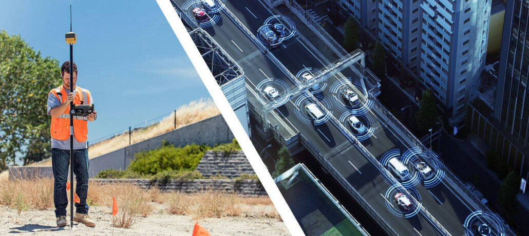
RTK surveying is a relative surveying technique, where two GNSS antennas measure their position relative to each other in real time. It involves a stationary base station that takes in and corrects GNSS data with RTK (Real Time Kinematics), and a human-operated rover with an antenna that communicates with the base station. By determining the coordinates of the base station and knowing the rover’s position relative to it, surveyors can determine the position of the rover and the features the rover is recording. RTK surveying techniques improve upon traditional surveying techniques by providing accuracy on a centimetre level and immediate initialisation times. RTK surveying has been found useful both on its own and used in conjunction with traditional
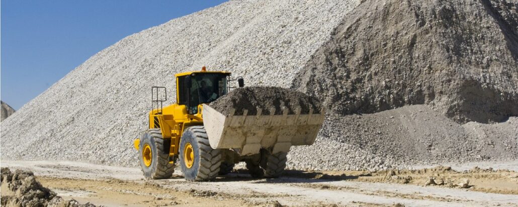
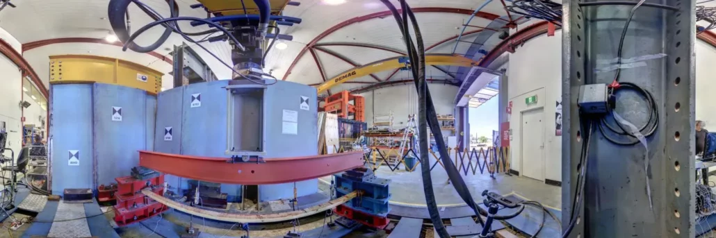
Having accurate scales in trade settings and on earthmoving machinery is integral. In ports, dumps, and garden centres, accurate scales ensure you’re not charging too much or too little for your goods and services. On earthmoving machinery, accurate scales ensure adherence to load bearing capacities and keep machine operators safe from overloading the machine and causing an accident. Even the highest quality industrial scales become less accurate over time, so it’s important to get them calibrated every 12 months generally, every 6 months in strenuous environments, or every time major hydraulic work is done on them. But how do you do it? Step 1 – Call Aptella Scale Calibration Services Aptella provide industrial scale calibration services and accurate
Masoud Mohammadi, a senior researcher of the Structural Assessment and Health Monitoring (SAHM) research group, led by Dr. Maria Rashidi at the Centre for Infrastructure Engineering (CIE), at Western Sydney University is collaborating with TfNSW on health monitoring of some state bridges across New South Wales. Mr Mohammadi and his team purchased the Z+F Imager 5016 3D Laser Scanner from Aptella because this instrument most reliably met the univeristy’s requirements and provided the highest quality results. The university completed stringent research before deciding to purchase the Z+F Imager 5016 3D Laser Scanner, as is the case with all special equipment purchases made by the university. The instrument needed to meet several requirements, including: cost of the instrument, local
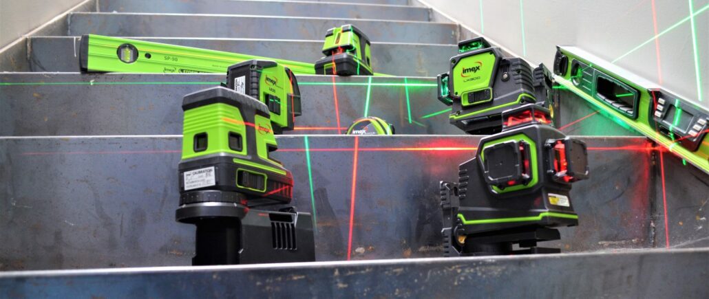
Aptella adds to its range of Topcon and aLine measurement tools with the acquisition of Imex, promising a laser to suit every budget and application. Intelligent positioning solutions provider Aptella announces the acquisition of Imex, an Australian-based company that specialises in laser levels and measurement tools for the building trades. “Laser levelling instruments have been a core part of our business since inception,” said Martin Nix, CEO of Aptella. “The addition of Imex to our solution portfolio means more options for our customers, with a laser level, or complementary measurement tool to suit every task and budget,” he added. “And, with outlets throughout Australia, as well as New Zealand, Indonesia, Malaysia and the Philippines, these essential construction
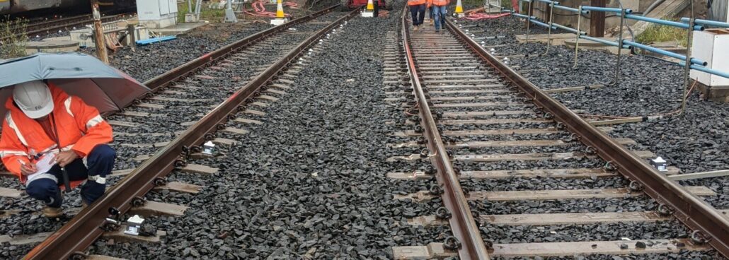
Australian surveying, digital & spatial and planning business Veris delivered around the clock deformation monitoring and reporting at Sydenham as part of the Sydney Metro City & Southwest Sydenham to Bankstown metro upgrade. Veris is a national, ASX-listed, company that provides comprehensive surveying, digital & spatial and planning services Australia-wide. Veris is currently providing surveying services for the Sydenham Metro Upgrade project, a major $301 million investment that involves significant upgrades to the existing rail track and Sydenham Station as part of the conversion of the T3 Bankstown line to Sydney Metro standards. Working closely with principal contractors John Holland and Laing O’Rourke, along with the client Sydney Metro, Veris recommended the use of wireless monitoring technology during
Aptella congratulates Richard Jackson on his appointment to Lead Product Management for Machine Control and GeoPositioning for Topcon Positioning Group. Passionate and visionary product engineer Richard Jackson will manage machine control and GeoPositioning product lines globally for Topcon Positioning Group. Aptella congratulates Richard Jackson on his latest promotion within Topcon Positioning Group. Based in Topcon’s Research and Development (R&D) facility in Brisbane, Australia, Mr Jackson has worked for the company for 21 years and has a longstanding working relationship with the Aptella team, Topcon’s exclusive Australian Distributor. “Richard is an innovative and skilled engineer who keeps the end user in mind when developing solutions,” said Martin Nix, CEO of Aptella. “We congratulate him on his appointment to lead