With nearly 15 years in reality capture, Nathan Cossar, Beca’s Spatial Technology and Innovation Lead, knew precisely where the L2 Pro would earn its place.
“It’s an extension of our toolkit. For the right application, it enables us to undertake tasks in a far more efficient manner.”
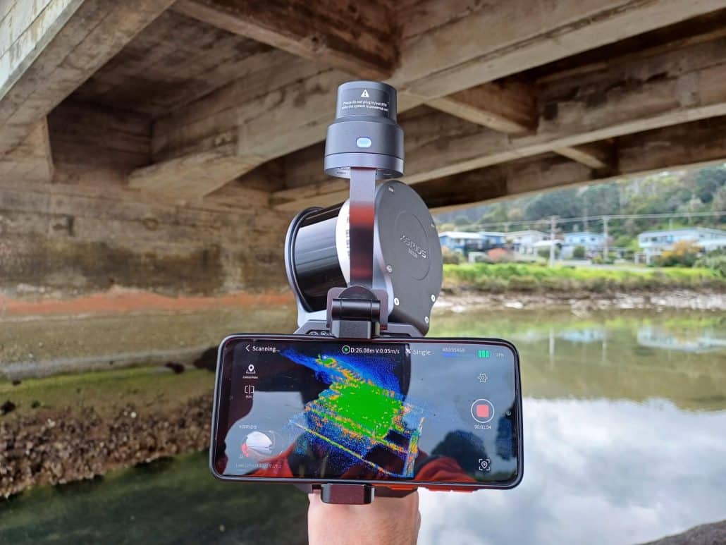
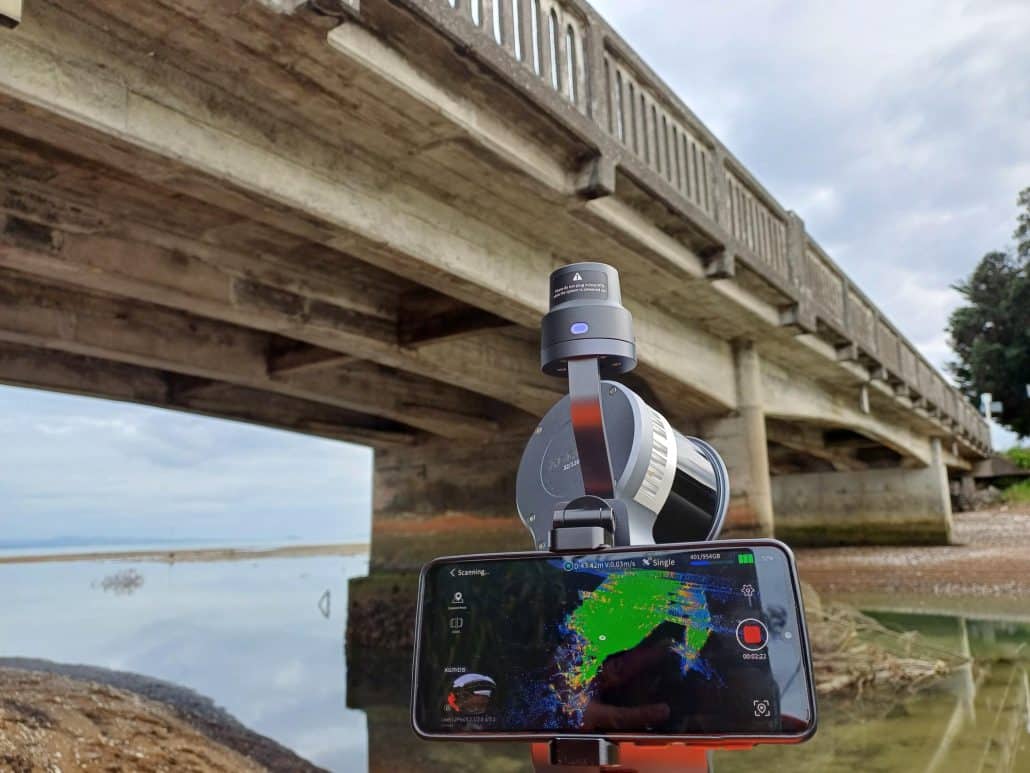
That right application can vary greatly. Road corridors captured in under half an hour. Bridge inspections where clients need basic geometry without a full survey mobilisation. Waterfront structures scanned from a boat because a tripod simply can’t go there. Engineers flying to remote sites for client meetings who return to the office with a full 3D spatial reference ready for desktop review. The list goes on.
“It fills the gap between a comprehensive survey and having no information at all. In a lot of cases, this provides enough information for the project to move forward, and that’s genuinely valuable, when you use it right.”
The L2 Pro combines LiDAR sensing, a 48MP panoramic camera system, and an integrated IMU to produce real time coloured point clouds on the move. No tripod, no repositioning, 3cm absolute accuracy. It’s spread through Beca’s teams organically, project team by project team, driven by results rather than a formal rollout.
For Nathan, the Aptella relationship has been part of why it’s worked, particularly having a support contact who genuinely understands surveying, not just the hardware.
“Louie Schutte, the Site Solutions Manager from Aptella, comes from a surveying background himself. That means he actually understands what we’re trying to achieve. That made the whole relationship different.”