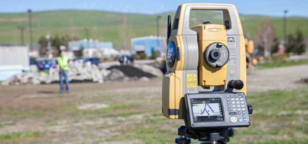
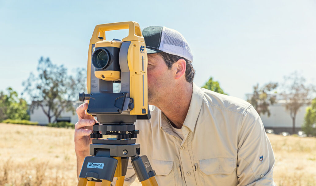
Topcon Positioning Systems has introduced the DS-200 with superior tracking technology to the Australian market. The DS-200 system sets a new standard for entry-level robotic total stations, providing accuracy, durability, reliability and compatibility with Topcon GNSS hardware. Aptella Survey Products Manager Cameron Waters describes the DS-200 as a “feature-rich product, boasting high-end capability without the high-end price tag”. The Topcon DS-200 is the ideal tool across a range of surveying disciplines, including cadastral, engineering and construction work. It also uses the same batteries as the Topcon HiPer GPS series, making them a perfect partner. The DS-200can be used safely in environments of high dust and water, allowing for greater productivity in the field. It comes with the world’s
Craig Miller, a Director at Perth-based Vision Surveyors, outlines the increase in productivity and efficiency the company has achieved thanks to the latest in survey technology. Established in 2004, Vision Surveys specialises in land development and strata titles, employing four survey crews. In recent years, the company has invested in the latest technology from Topcon and is seeing dramatic improvements in time saving and in-field efficiency as a result. “We’ve undergone major upgrades to our survey equipment twice in the last four years,” Mr Miller explains. “In 2010, we got talking with the team at Aptella and they were able to demonstrate some of the latest Topcon technology for us, which was a huge improvement on our setup

Combining Ground Penetrating Radar (GPR), laser scanning and Unmanned Aerial System (UAS) technology to deliver underground, structural and aerial imagery for accurate asset and property management. Maintenance of a building over its lifetime is reported to cost more than the building’s original construction. Knowing where underground services and building assets accurately sit is a challenge that can add time and cost to any work carried out. Old plans, many of which are original paper designs or mud-maps can often prove unreliable as more often than not, assets are repositioned during the build. Reliable facilities management data that includes accurate location information can help facilities managers better plan their maintenance actions and reduce costs. The older the structure, the
There is much written about lower productivity levels in construction compared with other industries. Manufacturing is acknowledged as more productive and much of its productivity gain is attributed to IT adoption driving automation. There are also claims that around 20% of construction costs go to waste. As a result, global construction is expected to become an industry that will benefit significantly from improvements in collaborative practices and technology innovation. In addition to the general uptake of technology in the construction industry, one key area for improvement is to connect various aspects of a project from initial design and mass haul planning through to haul progress and reporting, enabling different disciplines, contractors and subcontractors to collaborate across the job.
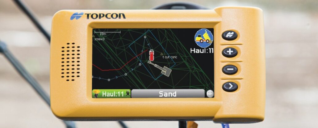
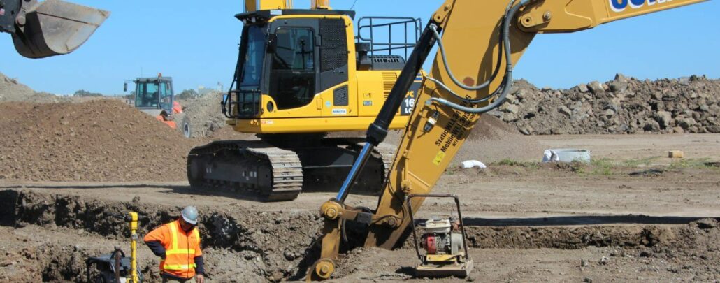
Topcon’s new HT-30 is a simple yet highly efficient system that automates haul counting and facilitates the management and tracking of material payloads across a project. The system features a small, portable, GPS-enabled control box that mounts into the haul truck cab. As the truck is loaded, data including material type, driver details and load quantity is input into the system. The load is then integrated into Aptella’ remote site management interface, Tokara Site (powered by Topcon SiteLink3D). Using Tokara Site, engineers and construction managers can track each load in real time for scheduling, rerouting and recording once delivery is made. “Topcon’s HT-30 system eliminates the need for manual counting and paper-based haul progress reporting,” explained Joel Seddon,
Brendan Cornfoot from Somerton-based Cornfoot Bros in Victoria, says they use a wide range of Topcon 3D GPS technology on the company’s two CAT D6 dozers, two CAT compactors, two CAT H Series graders and one M Series grader, two CAT and one Komatsu excavators. The business specialises in a wide range of earthworks applications, including final trim, bulk work, civil projects and landfill construction and capping. “We purchased our first GPS grader system around eight years ago from Topcon’s Australian distributors, now known as Aptella, and we haven’t looked back since,” Mr Cornfoot explained. “These days it’s a standard part of our business and every time we get a new machine, it gets fitted with Topcon.” When
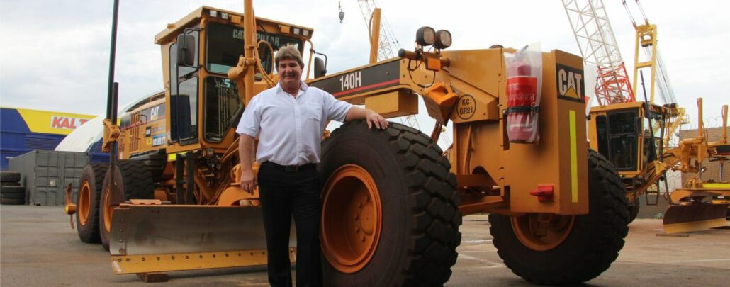
Now celebrating their 10th year in business, David Kais founded Kais Contractors in 2004 with a single grader. Today the company owns 23 graders and has become the largest Caterpillar grader hire business in the state, specialising in final trim work using Topcon GPS and LPS technology. “We have had a close working relationship with Topcon’s Australian distributor Aptella from the very beginning,” Mr Kais explained. “We operate both LPS and GPS Topcon machine control across our range of CAT 140H, 140M and 14H, 16H and 16M machines. We’re 100% Topcon and we’re 100% CAT.” When the company first started out, LPS and GPS machine control was not as common on job sites as it is today. “We’ve

Following extensive market research and testing, one of Australia’s largest coal mines is set to increase productivity and safety by deploying Unmanned Aerial System (UAS) technology. Gary Robertson is a registered surveyor and senior engineer at a large coal mine in Central Queensland. His working teams have been nominated for Delivery Improvement Awards the past three years running, while he has been awarded ‘Young Professional of the Year’ at 2013’s Queensland Spatial Excellence Awards and nominated for the ‘National Individual Award’ at the upcoming Asia-Pacific Spatial Excellence Awards. Mr Robertson has a unique ability to discover ways in which the latest technology can be adapted and intertwined to benefit mining productivity. For example, he recently worked with technology