Remotely piloted aircraft systems (RPAS) are fast becoming a mainstay of surveying, engineering and geospatial applications. The technology, computer processing speeds and data integrity have come a long way since their first introduction as aerial mapping instruments in 2011. And it’s fair to say their in-flight stability, battery life and overall reliability have also improved tenfold or more.
Intelligent positioning solutions provider Aptella was the first to introduce a survey-grade RPAS in 2011. “We are continuously on the look-out for innovative solutions from around the world that will improve productivity for our customers,” said Gavin Docherty, RPAS manager for the company.
“It was a steep learning curve to begin with and the workflow was cumbersome, but we saw the potential early on for this technology to provide real benefits, particularly in Australia and New Zealand for surveying large areas, hazardous sites or challenging topography.”
Although available in a variety of configurations and styles, the majority of survey mapping drones fall into two categories: multi-rotor or ‘copter style aircraft that are handy for inspecting infrastructure and other hard to reach areas; and fixed-wing, aeroplane-style models that are widely used to map large scale areas such as mine sites, agricultural properties and forests.

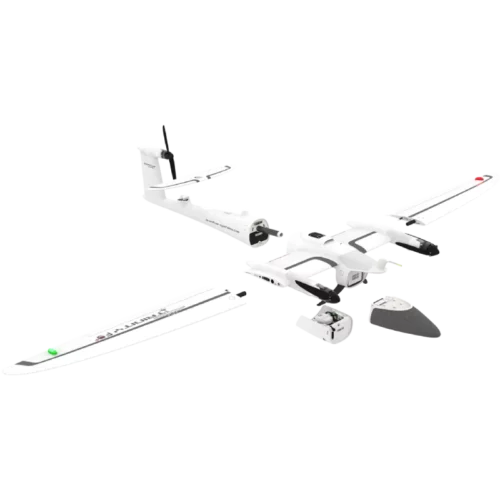
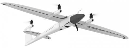
One such option is the Trinity F90+ system, made by German firm Quantum Systems and distributed in Australia and New Zealand by Aptella. Unlike many fixed-wing drones that require the aircraft to “belly land” (often causing significant damage or total failure of the wings and body), the F90+ takes off and lands using small propellers mounted to the top of the wings. With vertical take-off and landing, or VTOL, the Trinity F90+ can be used for a wider range of applications, safely, as Mr Docherty explained.
“The Trinity combines some of the key benefits of both fixed wing and ‘copter style aircraft, because the vertical take-off and landing means it only needs a small area to start and finish a flight safely, but it has the longer flight times and better in-flight stability of fixed-wing aircraft to handle large areas including mines and forestry applications.”
Used widely in Australian mine sites, the Trinity boasts a 90-minute flight time and often reduces or even eliminates the need for manned aerial mapping work. Chris Nixon, a mine surveyor in the Hunter Valley, said the long flight times and safety features make the Trinity a great choice for mining.
“We work on a number of worksites that are high risk or with restricted space, so having a VTOL RPAS is a big tick for us. The Trinity is certainly bridging the gap between little drones and manned aircraft – this also benefits the client as we can spend less time in the field and still capture large areas, which is better value for money.”


Thanks to advances in flight time and processing speeds, survey drones can now be used in conjunction with terrestrial scanners to enable environmental projects such as carbon offsets. In recent trials, the Trinity has been successfully used to calculate carbon credits in conjunction with terrestrial scanning solutions.
“By mapping an area of rainforest and supplementing the data with samples of terrestrial scans taken underneath the tree canopy, scientists can use the data to extrapolate carbon offsets over larger areas,” Docherty added.
Like the drones, 3D terrestrial scanners are also becoming less cumbersome, with new wearable mobile mapping solutions such as the NavVis VLX, dramatically reducing data capture time whilst maintaining excellent data integrity.
In addition to the improved hardware performance of mass-data capture devices such as RPAS and terrestrial scanners, is the versatility of the payload options to deliver survey-grade accuracy of the data.
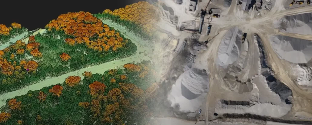
From thermal imaging and multispectral data capture to monitor vegetation and crops, to photogrammetry that can be used to produce orthophotos, point clouds and digital elevation models (DEMs), the Trinity can also be paired with a geomatics-grade LiDAR scanner.
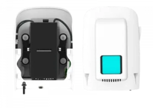
The aircraft can carry various sensors of up to one kilogram in weight, that can be quickly switched in the field without any tools via a quick-release bracket.

Mark Steggall, a civil engineer and Managing Director of Stegg Civil, is impressed with the versatility of the Trinity and the various outputs it enables him to offer his clients.
“I am continually amazed at the accuracy of the Trinity F90+ with little or no ground control points. The constant updates and improvements by Quantum Systems makes this a great product to be partnered with and the Altium payload means I can expand my business into the ag market.,” he said.
Lastly, but arguably most importantly, is the rapid expansion of software solutions and increased computer processing speeds in recent years that enable the vast quantity of data captured to be processed and used efficiently.
“In the early days of aerial mapping, the data processing times were huge and the resulting orthophoto could be very cumbersome to use and extract information from as you needed specialist computers to run it,” Mr Docherty said. “Now with most software platforms offering web-based viewing and analysis tools, and cloud hosting, the data is readily accessible and easy to share with key stakeholders.”
Similarly to payload options, Mr Docherty explained that there’s a software option to suit just about any application or even expand the functionality of the hardware itself.
“When it comes to multirotor options that are best suited to inspection work such as bridges, powerlines and other infrastructure, certain software packages can get more from the hardware so you can do more with the same aircraft,” he said. “One example is UgCS software, that can enable DJI Mavic 3 users to fly complex missions and dramatically improve vertical accuracy.”
To help sort through the plethora of choices, Mr Docherty always advises starting with the end result you’re looking for. “We always start by asking customers about the data output and formats they need, before working backwards to look at the best payload options, hardware and positioning setup to give them the most workable solution,” he said.

We source, deploy and support intelligent positioning solutions to enhance our customers’ productivity.
Aptella Pty Ltd
ABN 56 130 367 065