Expect delays on online orders during the Christmas period, between December 19 and January 5

What are the latest geospatial solutions to benefit local councils?

navvis 3d laser scanner

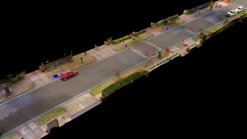
Upgrading surveying techniques for councils For surveyors working with councils and local governments, integrating robotic total stations and GNSS equipment is part of everyday surveying work. Many local councils throughout Australia complete a wide range of geospatial and surveying works. The requirements for each of these jobs varies widely depending on factors like whether the location is within a city or regional town, but these traditional methods of robotic total stations and GNSS equipment are currently commonplace. But a look at new surveying technology has uncovered new surveying options for councils. Some of the best technology for councils in 2023 is supplementing traditional surveying methods with MAGNET software, survey drones, wearable mobile scanning systems, and wireless monitoring –

How remote support and high accuracy positioning benefit the regional government

Supporting regional councils with remote support Remote support for regional councils has become increasingly important in recent years, as local governments continue to rely on modern technologies to carry out their work. In particular, the use of GNSS (Global Navigation Satellite System) technologies has revolutionized the way that councils carry out surveying work in the field, allowing for faster and more accurate data collection than ever before. Using AllDayRTK networks One of the key challenges that regional councils face when carrying out in-field GNSS work is the need for a reliable network positioning infrastructure. Traditionally, this has required the use of personal base stations, which can be costly to set up and maintain. However, with the advent of