
Supporting regional councils with remote support Remote support for regional councils has become increasingly important in recent years, as local governments continue to rely on modern technologies to carry out their work. In particular, the use of GNSS (Global Navigation Satellite System) technologies has revolutionized the way that councils carry out surveying work in the field, allowing for faster and more accurate data collection than ever before. Using AllDayRTK networks One of the key challenges that regional councils face when carrying out in-field GNSS work is the need for a reliable network positioning infrastructure. Traditionally, this has required the use of personal base stations, which can be costly to set up and maintain. However, with the advent of
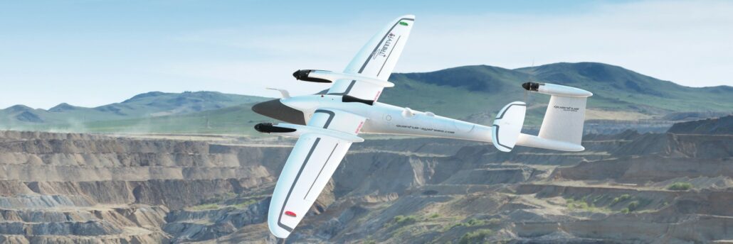
From calculating carbon credits to LiDAR mapping, the versatility of aerial mapping applications is expanding at pace. Remotely piloted aircraft systems (RPAS) are fast becoming a mainstay of surveying, engineering and geospatial applications. The technology, computer processing speeds and data integrity have come a long way since their first introduction as aerial mapping instruments in 2011. And it’s fair to say their in-flight stability, battery life and overall reliability have also improved tenfold or more. Intelligent positioning solutions provider Aptella was the first to introduce a survey-grade RPAS in 2011. “We are continuously on the look-out for innovative solutions from around the world that will improve productivity for our customers,” said Gavin Docherty, RPAS manager for the company.
The collaboration between Aptella and u-blox will facilitate the rollout of accurate positioning for a diverse range of applications, from autonomous shuttles and public transport to service robots and other Internet of Things (IoT) uses. u-blox (SIX:UBXN), a global provider of leading positioning and wireless communication technology and services, and Aptella, an Australasian provider of intelligent positioning solutions, have announced today the expanded coverage of the PointPerfect global navigation satellite system (GNSS) augmentation service to Victoria and New South Wales, including Melbourne and Sydney, as an initial step in rolling out the service to the Australian and New Zealand markets. Access to industry-standard high accuracy positioning for fleet and Internet of Things applications Available via Thingstream, u-blox’s enterprise-grade IoT
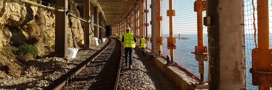
Asset Survey Solutions, a multi-discipline survey company, implemented the Senceive FlatMesh wireless sensor network from Aptella into its current project. Rail corridors are notoriously troublesome to conduct monitoring using traditional survey methods, so when Darren Dean, Survey Manager and Director of Asset Survey Solutions was starting work on a rail project as part of the LXRP removal projects in Victoria, Mr Dean knew he wanted to get the Senceive FlatMesh Network which was supplied and supported by Aptella, implemented to increase safety for his team whilst streamlining productivity and being cost effective for his clients. Prior to implementing the Senceive FlatMesh wireless sensor network , Asset Survey Solutions would have had to have multiple surveyors, in person, positioned taking
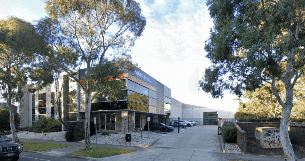
Aptella has relocated its office in Melbourne’s northwest from Campbellfield to 42 Enterprise Drive, Bundoora. The new branch offers a service centre, showroom and a national warehouse that support customers in the civil construction, building, geospatial and mining sectors. The company’s former premises at 7 Transit Drive, Campbellfield were destroyed by a widespread fire on Christmas Day 2022, caused by an electrical fault. “We appreciate the support of our customers, suppliers and partners as we have worked through the impact of the unfortunate fire at our Campbellfield branch,” said Martin Nix, Aptella CEO. “Thanks to the extraordinary efforts of our people and partners such as Topcon we have returned to normal operational business and are now able to
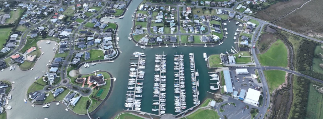
Hopper Construction is an established civil construction company located in Orewa, Auckland, that has been using MAGNET Office from Aptella for over nine years. “Hopper Construction offers extensive experience in the construction of quality subdivision developments as well as a wide range of other civil construction services including municipal wastewater treatment plants. We have unrivalled expertise in complex canal and marina construction in New Zealand,” said Gavin Sims, Project Manager of the Marsden Cove Waterways Development and Survey Manager, Hopper Construction Ltd. “Our current applications for the MAGNET Office are: pulling set out information from received design data, creation of 3D surfaces for machine control data (diggers and bulldozers), in-house cut – fill design checks, basic design in
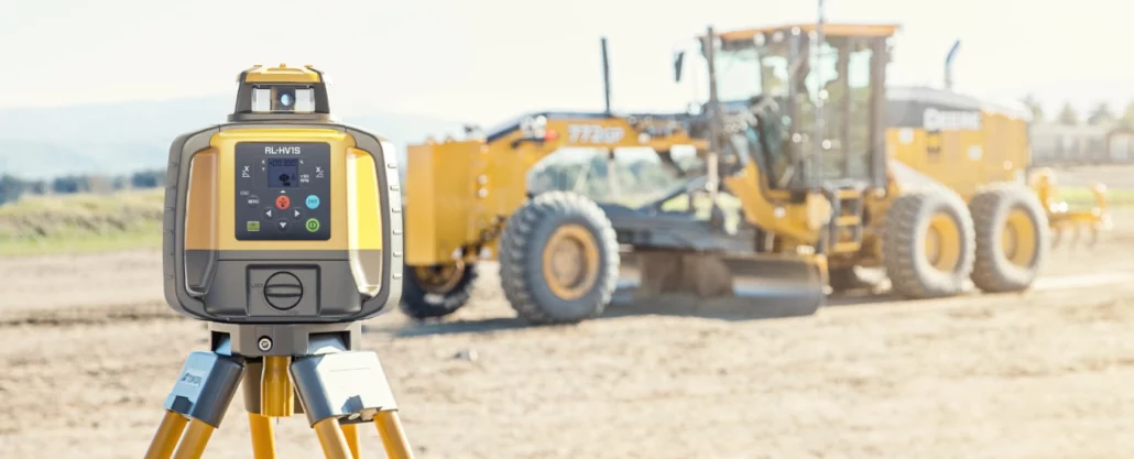
Available in single or dual grade, the HV series replaces popular SV models with enhanced features and connectivity options. Topcon Positioning Systems has released a new range of grade laser levels, the RL-HV series. Designed for all manner of construction applications and building trades, the HV series replaces the popular RL-SV series laser levels and comes in either single or dual grade models. New to the HV series is the ability to remotely control the unit using a smartphone. Users simply connect the laser level to Topcon’s Laser Manager app, available on both iOS and Android devices, to adjust slope and laser level settings, or perform calibration checks. Many of the same features users loved in the SV
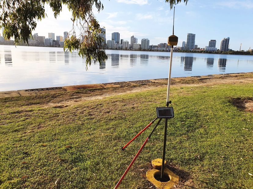
Vision Surveys Consulting, a cadastral survey company, was ready to upgrade its instruments after experiencing frustration with the lack of satellites being observed with the existing equipment. After meeting with Aptella and doing a trial of the Topcon Hiper HR GNSS receiver in combination with the AllDayRTK CORS network, Chris Owen, Survey Coordinator at Vision Surveys Consulting, noted a marked improvement in efficiency and better network results. “Having all the satellite constellations available with the Topcon Hiper HR makes a noticeable difference. Previously, with the Topcon Hiper SR, being under or even near trees could lead to a loss of fix, but with the Topcon Hiper HR it’s amazing the locations you will maintain an accurate and reliable