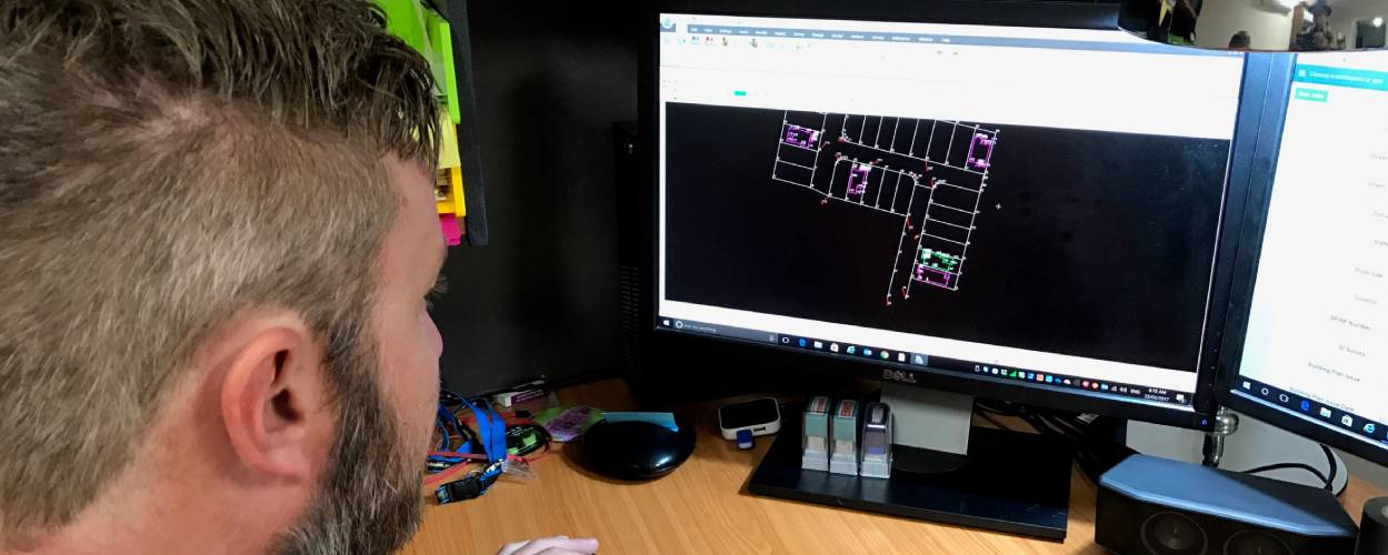
Not too long ago, surveying software was confined to tiny Windows Mobile field controllers with minimal memory and limited capabilities. Surveyors could barely load basic data, let alone complex design files. Fast forward to today, and the landscape has dramatically changed. With the advent of powerful tablets and sophisticated operating systems, surveyors now carry entire digital ecosystems in their hands—a far cry from the constraints of early mobile technology.
“The software has moved past its original limitations,” explains Patrick Gilbert, Survey Solutions Specialist at Aptella. “We’ve gone from small 4-inch LCD screens to 7 and 10-inch tablet screens that allow you to load and manipulate entire design files in the field. Better memory management means you can now take complex designs on-site without slowing down your entire system.”
This evolution is more than just a technological upgrade—it’s a fundamental reimagining of how surveyors interact with data. Unlike early software that treated surveying as a matter of drawing perfect geometric lines, modern solutions like Topcon’s recognise the complexity of the real world.
“Surveyors are transforming real-world 3D environments into digital models,” Gilbert explains. “CAD systems like Autodesk were originally designed for drafting plans—focusing on perfect squares and straight lines. But reality isn’t perfect. A building wall might have a subtle bulge, which traditional CAD software might ignore. Modern survey software is able to capture these nuances, ensuring that what designers see matches the actual physical environment.”
At the heart of Topcon’s approach is a commitment to user friendly, yet powerful software. The interfaces are deliberately designed to be intuitive, with large icons and clear hierarchical menu structures that allow even complex operations to feel accessible.
“What sets Topcon apart is that the software is designed specifically for surveyors,” says Gilbert. “The interface is easy to learn, yet the software underneath is incredibly powerful. Surveyors get the simplicity they need without sacrificing the complex functionality they require. It’s intuitive for them to get to work right away, without unnecessary complexity.”
Adam Burke, Aptella’s Executive Manager of Geospatial and Building, provides a complementary perspective: “Topcon Office gives surveyors the confidence to know their data is accurate from the start. The ability to process and manage everything in a single, seamless workflow saves significant time and reduces costly errors.”
Topcon Office emerges as the true powerhouse of this software ecosystem—a comprehensive solution that has forever changed how surveyors process and manage their data. Developed from the origins of Civil CAD, a software specifically designed by surveyors for surveyors, Topcon Office represents a quantum leap in data processing capabilities.
“With Topcon Office, everything is pre-built to follow exactly what surveyors would expect to see,” Gilbert explains. “Unlike generic CAD programs where you have to hunt for specific tools, this software understands the surveyor’s workflow intrinsically. It’s got all the tools they need, presented in a way that just makes sense.”
“Surveyors don’t want to waste time on convoluted software,” Gilbert adds. “With Topcon Office, everything is designed with their needs in mind. The software is built to make their jobs easier, not harder, which is why it’s become so popular with professionals in the field.”

David Banks, the National Sales Manager for Survey at Aptella offers a broader view of the software’s impact: “Topcon’s software isn’t just an add on—it’s the backbone of modern surveying operations. Competitor solutions often require workarounds, but with Topcon, everything just works seamlessly. That’s why surveyors love it.”
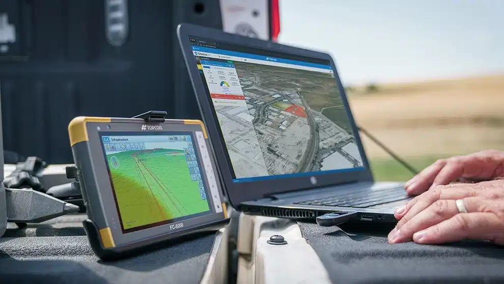
The software connects with Topcon Enterprise, a cloud based collaboration platform that allows real time data sharing among project teams, keeping all stakeholders informed and ensuring smooth project execution.
This philosophy extends across their software suite. Topcon Field captures GPS and robotic total station data. Topcon Digital Layout offers simplified tools for non-surveyors. And then there’s Topcon Tools—what Gilbert calls the “hidden gem” of their ecosystem.
“Topcon Tools has been somewhat neglected in marketing, but it’s remarkable,” he reveals. “It can generate reports with hundreds of variables, create complex graphs and plans that show processing details. For research students and technical professionals, it offers an unprecedented level of analytical depth.”
Burke adds a forward looking perspective: “Topcon’s ability to constantly innovate and adapt is what makes it stand out. With software like Topcon Office, surveyors aren’t just keeping up—they’re staying ahead of the curve.”
Looking ahead, Gilbert sees the future of surveying firmly rooted in what he calls “mass point capture” and digital twin technology. The goal is to create comprehensive digital representations of physical environments that allow for sophisticated simulation and analysis.
“The geospatial industry is moving towards creating complete digital twins,” he explains. “Imagine being able to simulate and test complex scenarios in a virtual environment without the massive costs of physical prototyping. We’re talking about using vast point cloud data to create representations so detailed that you can test design modifications, analyse structural challenges, and predict outcomes—all before breaking ground.”
This vision requires immense computational power. Gilbert anticipates a shift towards distributed computing and cloud based processing to handle the massive datasets modern surveying can generate.
Aptella, as the exclusive distributor of Topcon products in the Asia-Pacific region, stands at the forefront of this technological transformation. By providing surveyors with these cutting edge tools, they’re not just distributing software—they’re enabling a new era of precision and possibility.
The surveying world is no longer about simply measuring spaces. It’s about understanding them, representing them digitally, and unlocking insights that were previously unimaginable.